 Updates
Update: water & offshore mapping joins the stack
TwinSphere now spans space, air, ground and water — coastlines, ports, ships and offshore assets, in one continuous model.
Read more →Product updates, project stories, tutorials and use cases from the team mapping the world.
Updates
TwinSphere now spans space, air, ground and water — coastlines, ports, ships and offshore assets, in one continuous model.
Read more → News
News
Resolution is the currency of Earth Observation. A 30 cm satellite scene tells you a lot; a 7.5 cm one tells you whether a manhole cover has shifted. The catch…
Read more → News
News
We are building one platform that takes you from a satellite tasking all the way to a navigable 3D digital twin — no vendor juggling.
Read more →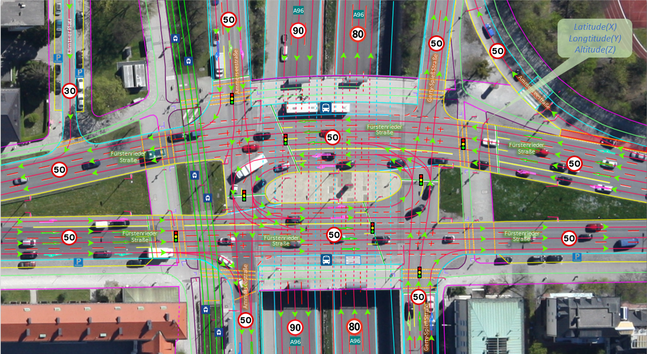 News
News
Autonomous-driving and ADAS teams do not need a pretty map — they need a precise, machine-readable one. So our HD mapping now exports directly to ASAM OpenDRIV…
Read more →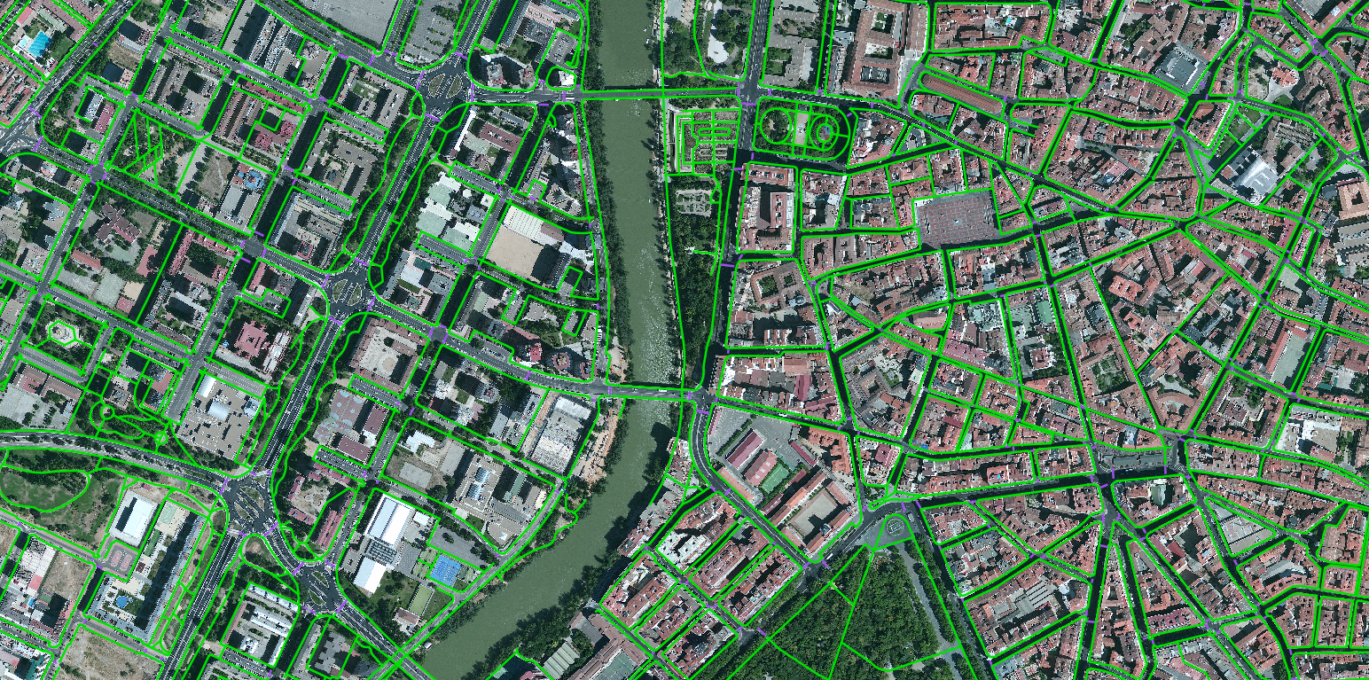 Datasets
Single-frame vehicle detection from high-resolution satellite imagery, split into large- and small-vehicle classes.
Read more → Projects
A comprehensive, high-precision vector map of every building across Australia and Oceania.
Read more →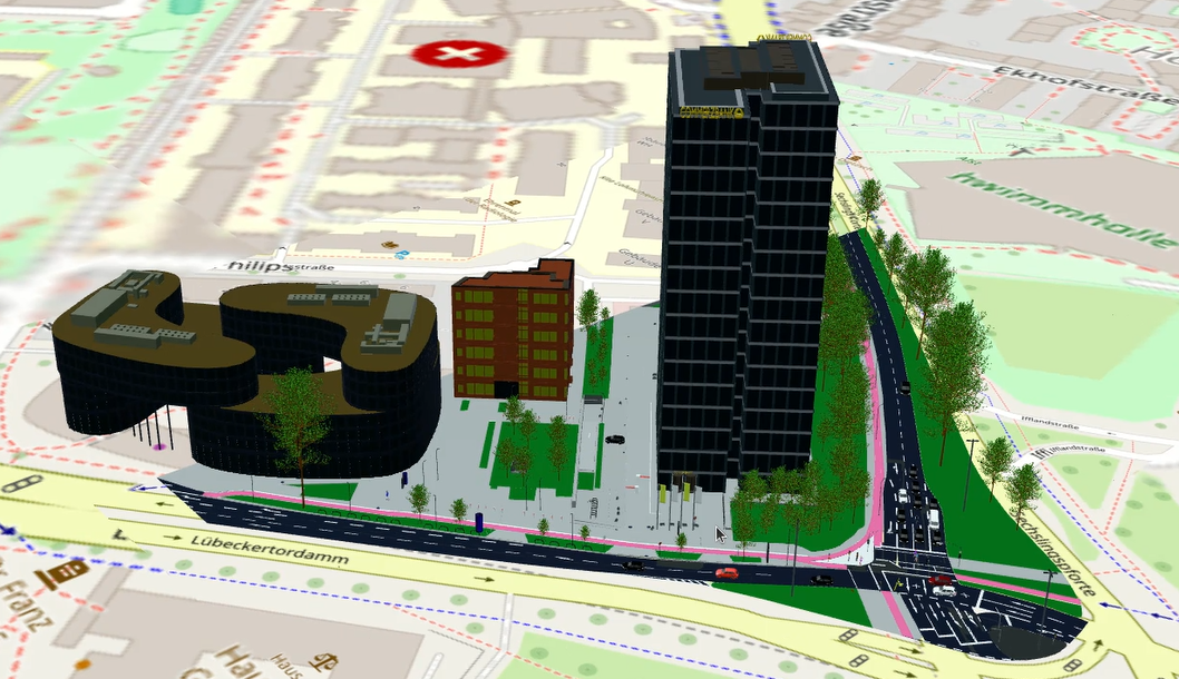 News
News
GIS is powerful and, for most people, intimidating. Buffers, joins, projections, attribute queries — the data holds the answer, but getting it out means knowin…
Read more →An AI-powered mapping system and partnership network that convert a complex, changing world into decision-ready data.
Read more →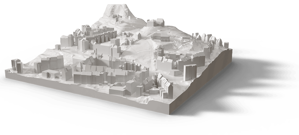 Projects
We took a single junction through every layer of our pipeline — the same workflow we run for an entire city.
Read more → Datasets
A 10-metre land-use/land-cover map segmented into 24 distinct classes — broad-area intelligence ready for analysis.
Read more →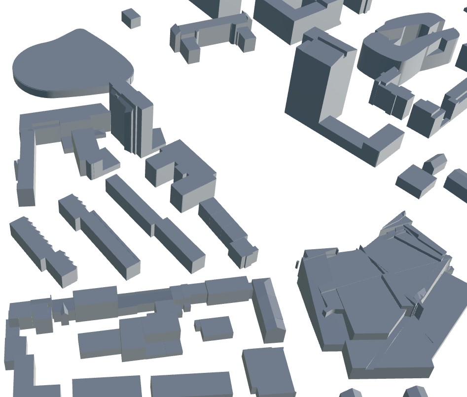 Tutorials
A “building” on a map can mean very different things. Sometimes it is a flat footprint polygon; sometimes a block extruded to a guessed height; sometimes a fai…
Read more → Tutorials
How drone mapping and aerial surveying transform infrastructure inspection for bridges, roads, pipelines and power lines — implementation, technology and AI integration.
Read more →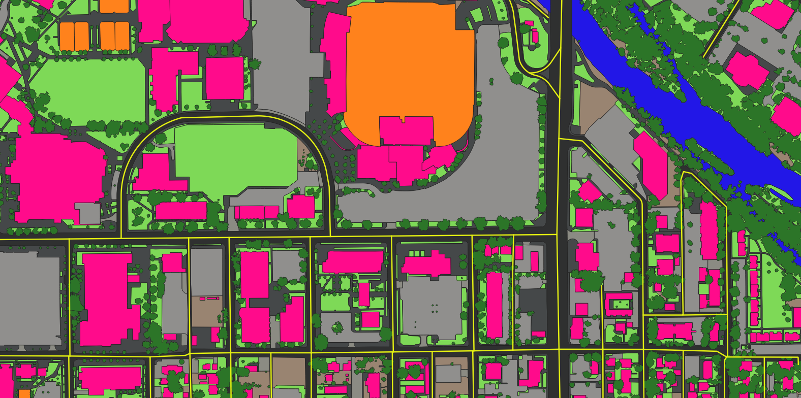 Projects
A continent-scale building dataset built for decision-making across planning, insurance, logistics and response.
Read more →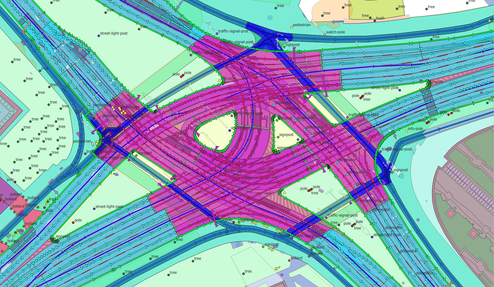 Tutorials
When rain falls on a forest it soaks in. When it falls on asphalt it runs off — fast — and that runoff is what overwhelms drains, floods streets and carries po…
Read more → Guides
The pipeline that turns raw pixels into impervious-surface intelligence — and intelligence into municipal decisions.
Read more → Tutorials
Lock an area of interest, choose a cadence, and get an alert the moment something changes on the ground.
Read more → Use cases
How AI-driven extraction lets national and regional GIS operations produce current data at a scale manual digitising never could.
Read more →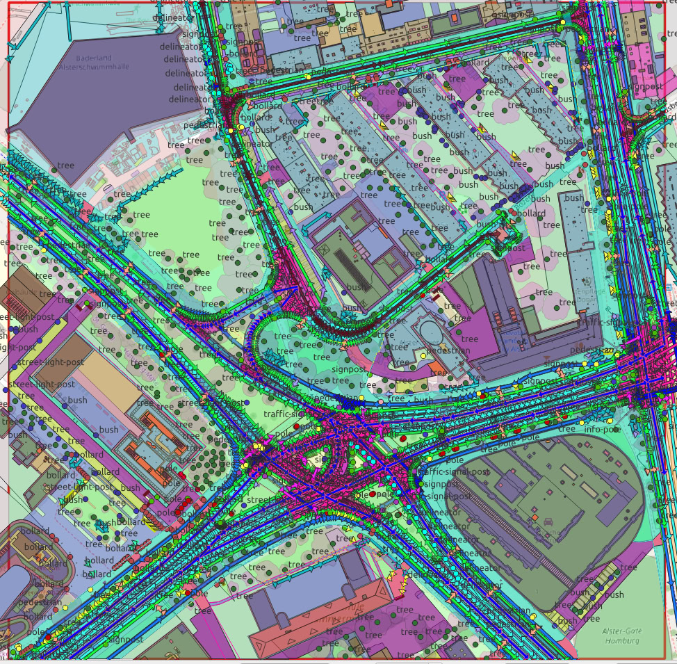 Tutorials
Building footprints are one of the most-requested geospatial layers — for cadastre, insurance, telecoms planning, population estimates and the base of every 3D…
Read more → Projects
Precise impervious-surface data turns stormwater fees, flood modelling and runoff planning from estimates into measurements.
Read more →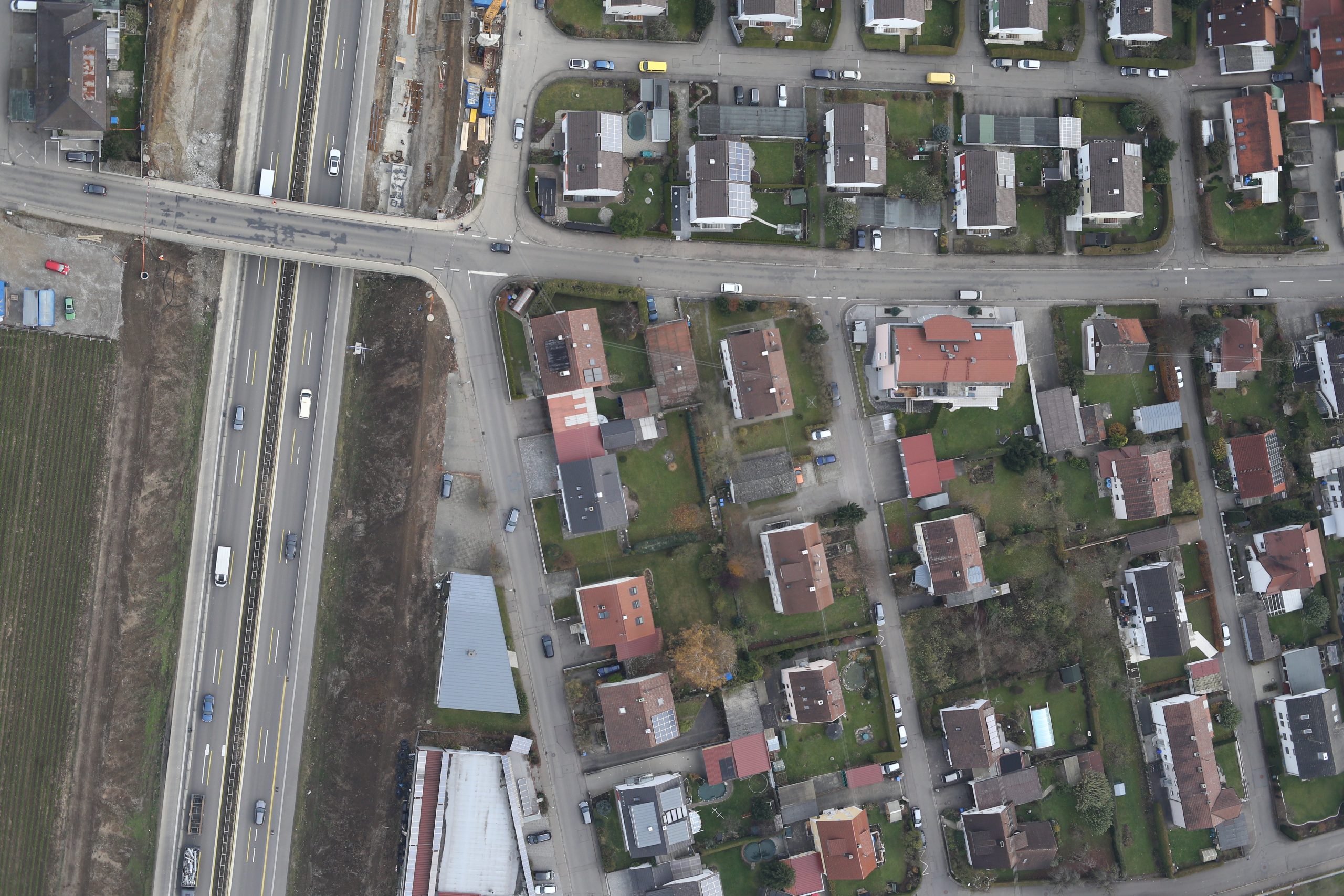 Case studies
Road-surface damage detected and sorted into cracks, patches and seams — scalable, data-driven condition assessment.
Read more → Tutorials
A digital twin you can only look at is a picture. A digital twin you can drive, fly and walk through is a simulator — and that is where the real value sits for…
Read more → Case studies
An intelligent map of Berlin's streets with parking-occupancy analytics layered on top of the road network.
Read more → Use cases
Self-driving programmes burn enormous time and money on two things: building accurate maps of where they operate, and testing the vehicle against the near-infi…
Read more →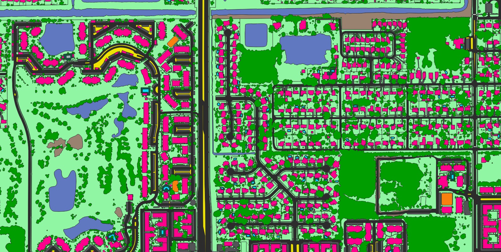 News
News
A high-definition mapping dataset for the Orlando metropolitan region, built to support urban planning.
Read more →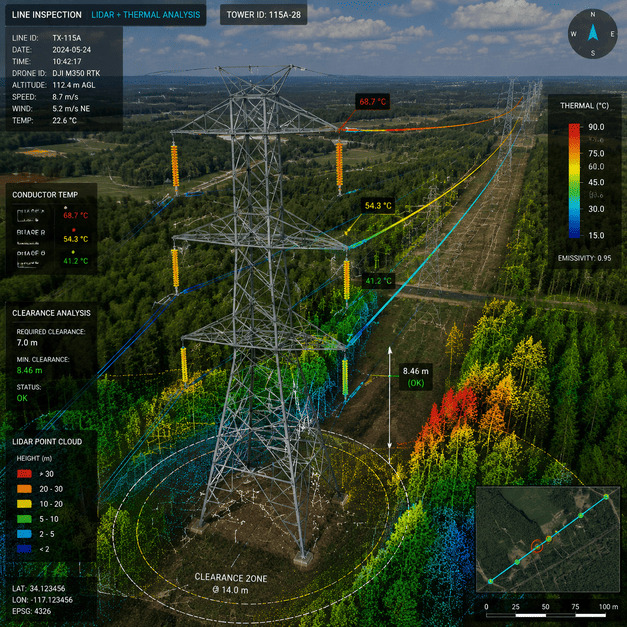 Use cases
How utilities use repeat imagery, AI and change detection to find risk along transmission corridors before it causes outages.
Read more →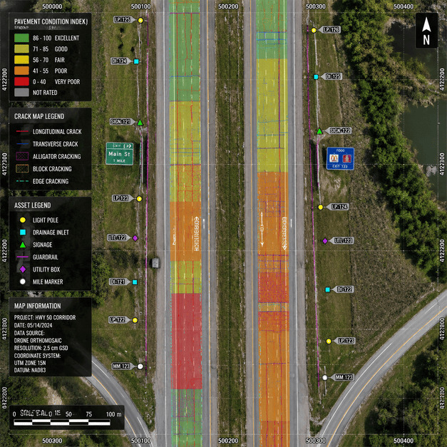 Tutorials
“We need a map” is the start of a conversation, not the end of one. The right product depends entirely on what you are going to do with it. Here is a plain-lan…
Read more →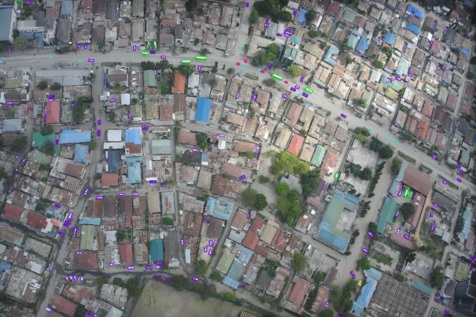 Projects
Multi-class vehicle detection with per-object attributes from low-altitude aerial imagery over Africa.
Read more →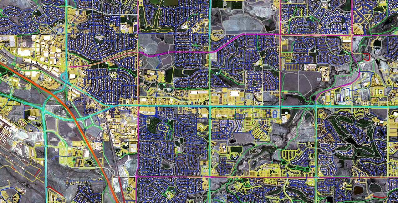 Guides
Four real-world ways GIS and detailed transport data widen access to jobs, healthcare and services.
Read more →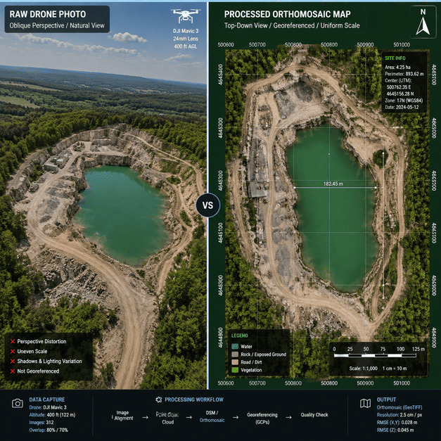 Use cases
When a flood, storm or earthquake hits, the first question responders ask is the hardest to answer quickly: what changed, and where? Crews cannot be everywhere…
Read more → Use cases
Modernising emergency response for a mobile society starts with accurate, current geospatial data.
Read more → Case studies
Land cover and road infrastructure mapped consistently across 17 Japanese cities — from Tokyo and Osaka to Sapporo and Sendai.
Read more → Use cases
Why a geospatial digital twin has become essential infrastructure for resilience, planning and analytics across industries.
Read more → Use cases
Planning decisions are spatial, but they are too often made on flat drawings and imagination. A digital twin — a true-to-life, measurable 3D model of the city …
Read more →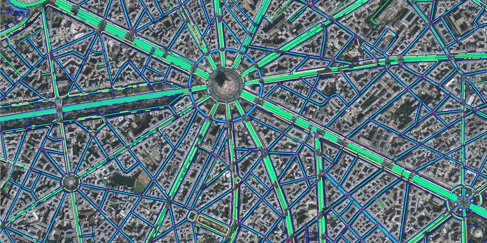 Case studies
France mapped into seven land-cover and land-use classes — forest, agriculture, urban, water, rangeland, bareland and road.
Read more → News
News
High-precision geospatial data to support Sapporo's active-transportation and urban-planning programmes.
Read more → Projects
Dams quietly run modern life — water, power, flood control. A complete, current geospatial inventory is the first step to managing their risk.
Read more →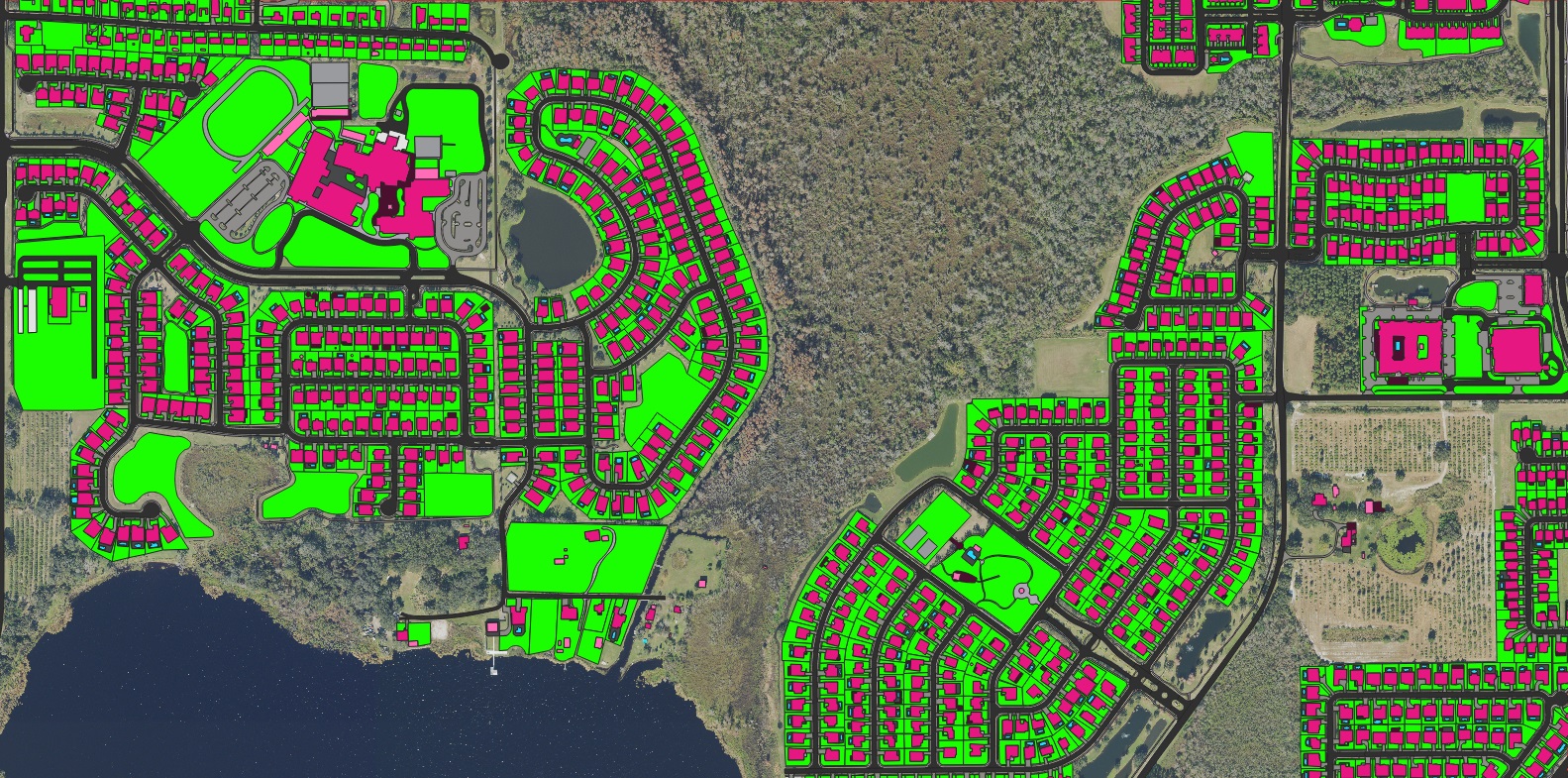 Use cases
When seconds count, an accurate, current road network is what lets dispatch find the nearest unit and the fastest route.
Read more →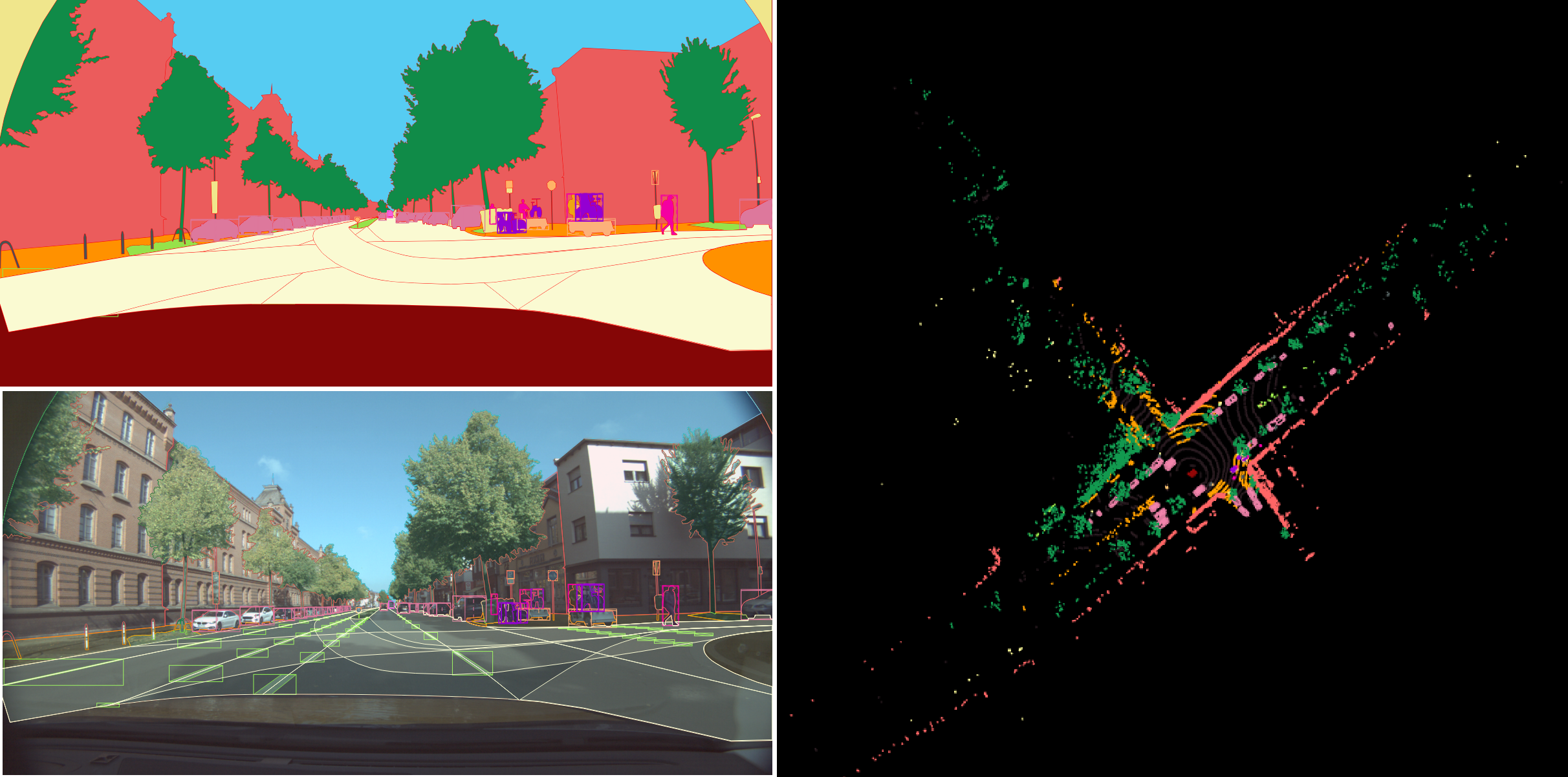 Case studies
Berlin's urban surface segmented into nine primary classes plus attributes — roads, shoulders, keep-out areas and more.
Read more → News
News
Fresh land-cover intelligence with dedicated agricultural classes — crops, bare soil, shrubland, wetland and more.
Read more → News
News
A geocoding platform that ties flood-zone analytics and change detection to each individual building.
Read more → Case studies
Vehicle damage detected from gate-camera images as oriented bounding boxes — automated inspection at the gate.
Read more →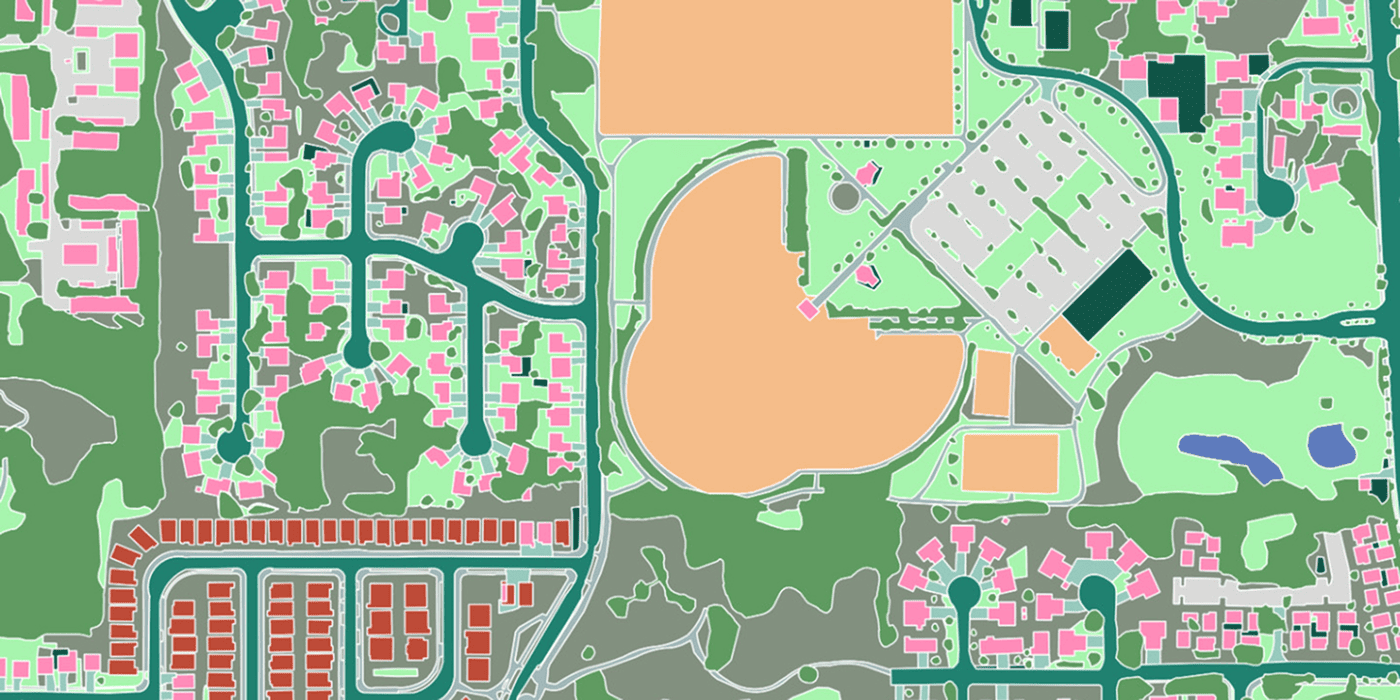 Use cases
Underwriting property risk at the building, not the postcode — geocoding precise enough to optimise a reinsurance portfolio.
Read more →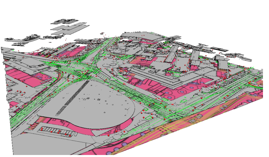 Guides
From insurance to logistics to planning — the many uses of accurate, attributed building footprints.
Read more →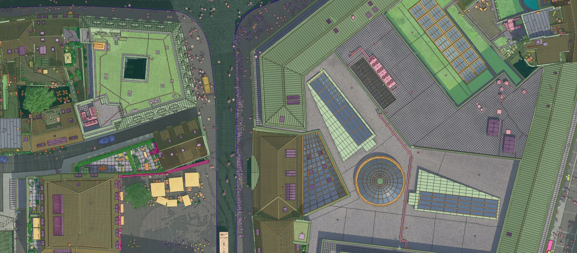 Datasets
An aerial dataset over Münster, Germany at 2 cm resolution — capturing the city in extraordinary detail.
Read more → Use cases
Combining predictive analytics with GIS to build safer, more accessible, lower-carbon transport networks.
Read more →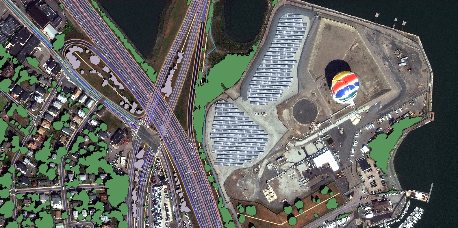 News
News
Geocoding to the building, not the street — HD vector maps that give underwriters a precise digital record of each structure.
Read more →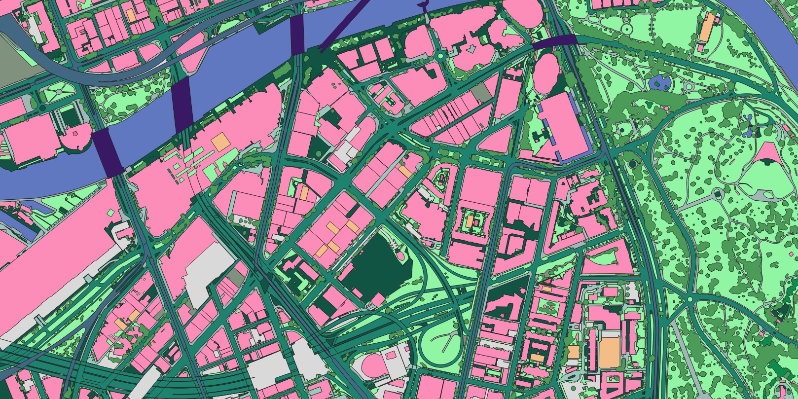 Case studies
Road-marking quality assessed across Roeselare, Belgium from satellite and panchromatic imagery.
Read more → Guides
Why time is the fourth dimension of mapping, and how automated change detection keeps a map honest.
Read more → Datasets
650 co-registered RGB-image and LiDAR point-cloud samples, labelled for multimodal model training.
Read more →Barcelona's surface mapped automatically into 13 land-cover and transportation classes for planning and environmental work.
Read more →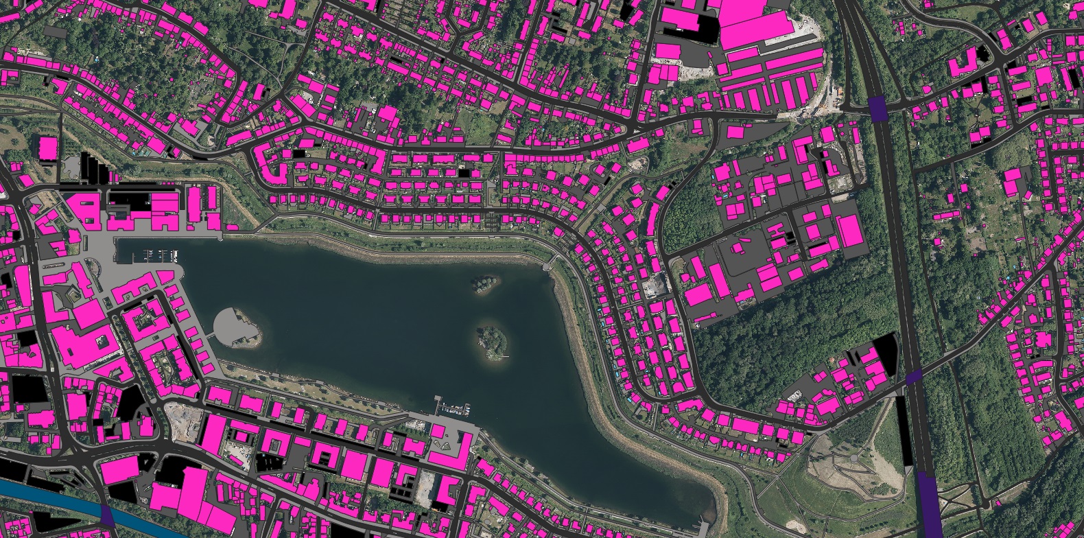 Projects
A full multi-layer feature extraction across the Munich University campus — points, polylines and polygons in one pass.
Read more →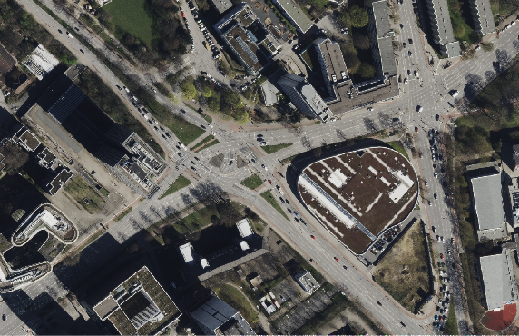 Datasets
Classifying road types from medium-resolution satellite imagery to complete the picture of a city's transport network.
Read more →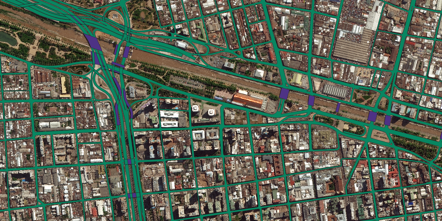 Use cases
High-resolution imagery and HD vector maps combined to give local government a current, reliable basemap for land administration.
Read more →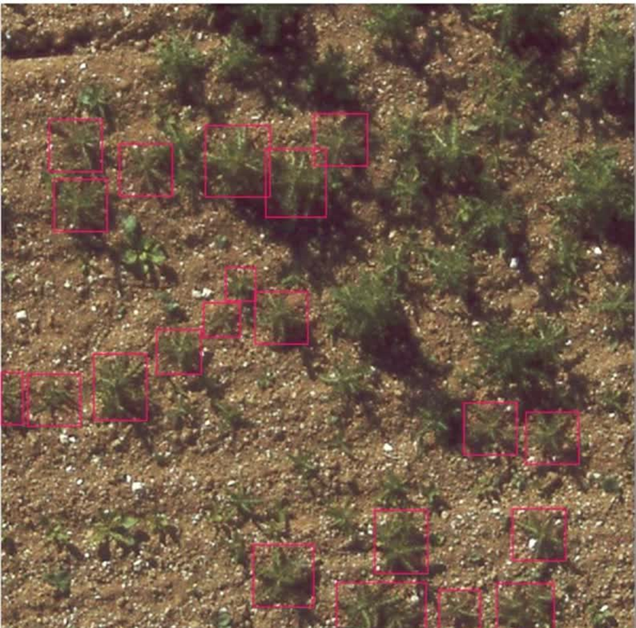 Case studies
Individual thistle weeds detected in agricultural fields with bounding-box object detection — precision agriculture in practice.
Read more → Projects
An HD map of the Leverkusen region built for automated driving — where lane-level precision stops being optional.
Read more →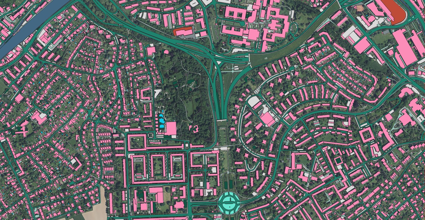 Use cases
How accurate basemaps and asset layers underpin civil-engineering work on telecommunications projects.
Read more →How detailed, current transport layers underpin safe, efficient mobility for DOTs and metropolitan planners.
Read more →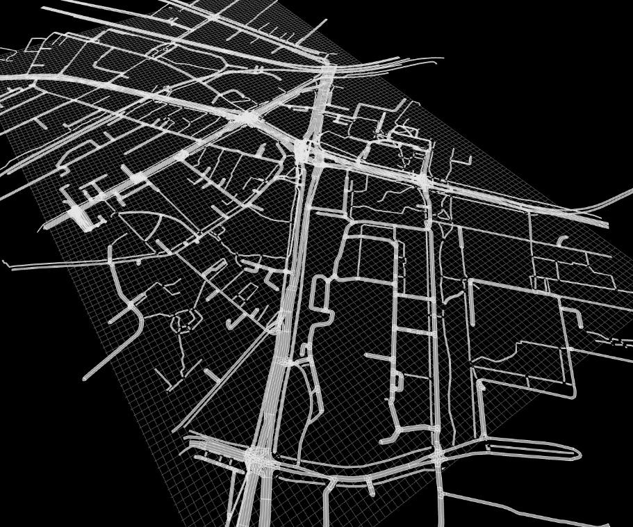 Case studies
Roadside elements — curbstones, fences, guardrails and borders — detected and classified into five categories.
Read more → Case studies
Fine-grained segmentation of individual vehicle parts from gate-camera images — each panel a labelled polygon.
Read more →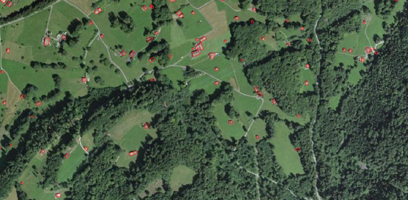 Guides
A practical checklist for municipalities adopting geospatial solutions for stormwater and impervious-surface management.
Read more →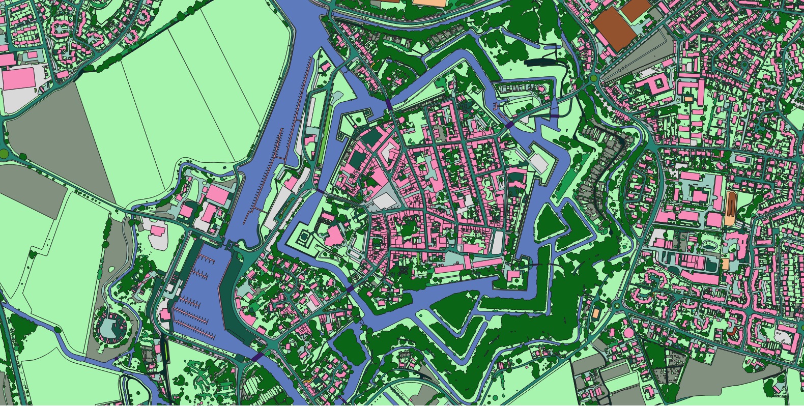 Projects
AI-extracted road, path and crossing layers reveal where a mobility network is incomplete — and who it leaves behind.
Read more →Multi-object tracking across drone video — per-frame boxes and continuous trajectories with attributes.
Read more → Use cases
Why building-based geocoding is the gold standard for property intelligence in insurance and beyond.
Read more →A tour of transportation mapping's many GIS applications — and where to get the data each one needs.
Read more →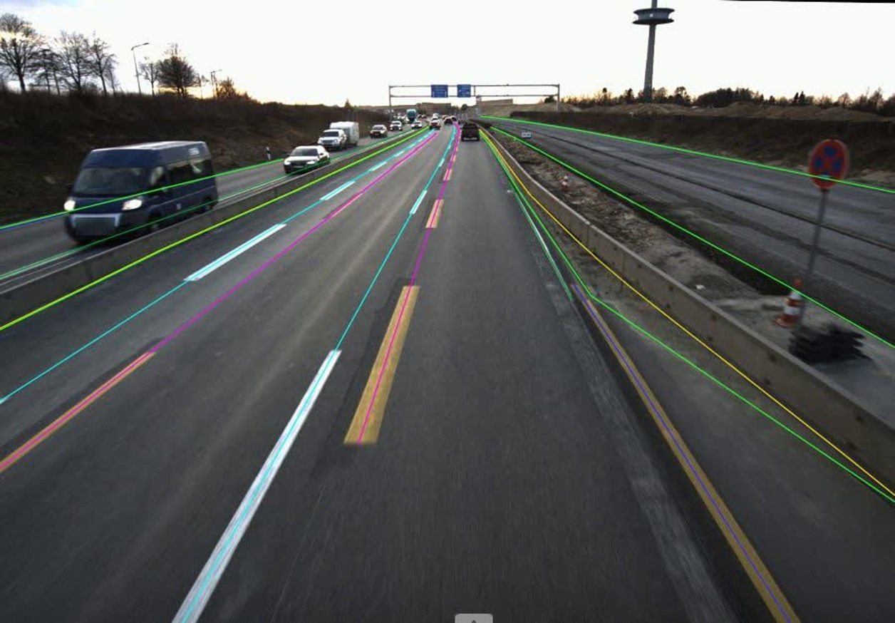 Datasets
Polyline road boundaries and route paths extracted at scale from 50,000 forward-facing EV dashcam frames.
Read more → Guides
What impervious-surface data is, how it is made, and why it has become essential to stormwater and land management.
Read more → Guides
A practical look at the EU programmes that can fund municipal stormwater and land-cover mapping work.
Read more →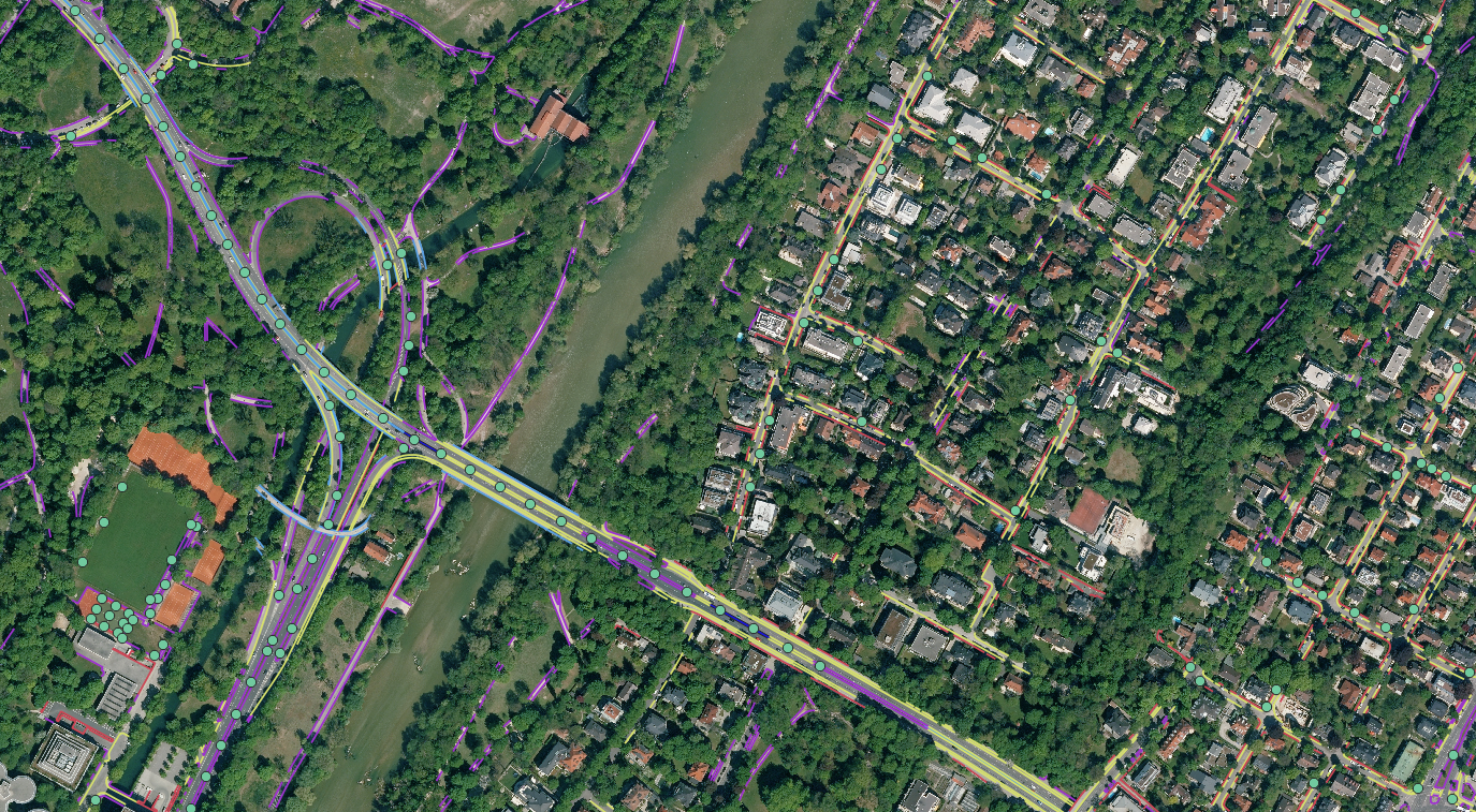 News
News
An accurate, current map of every building across Switzerland to plan rural broadband rollout.
Read more →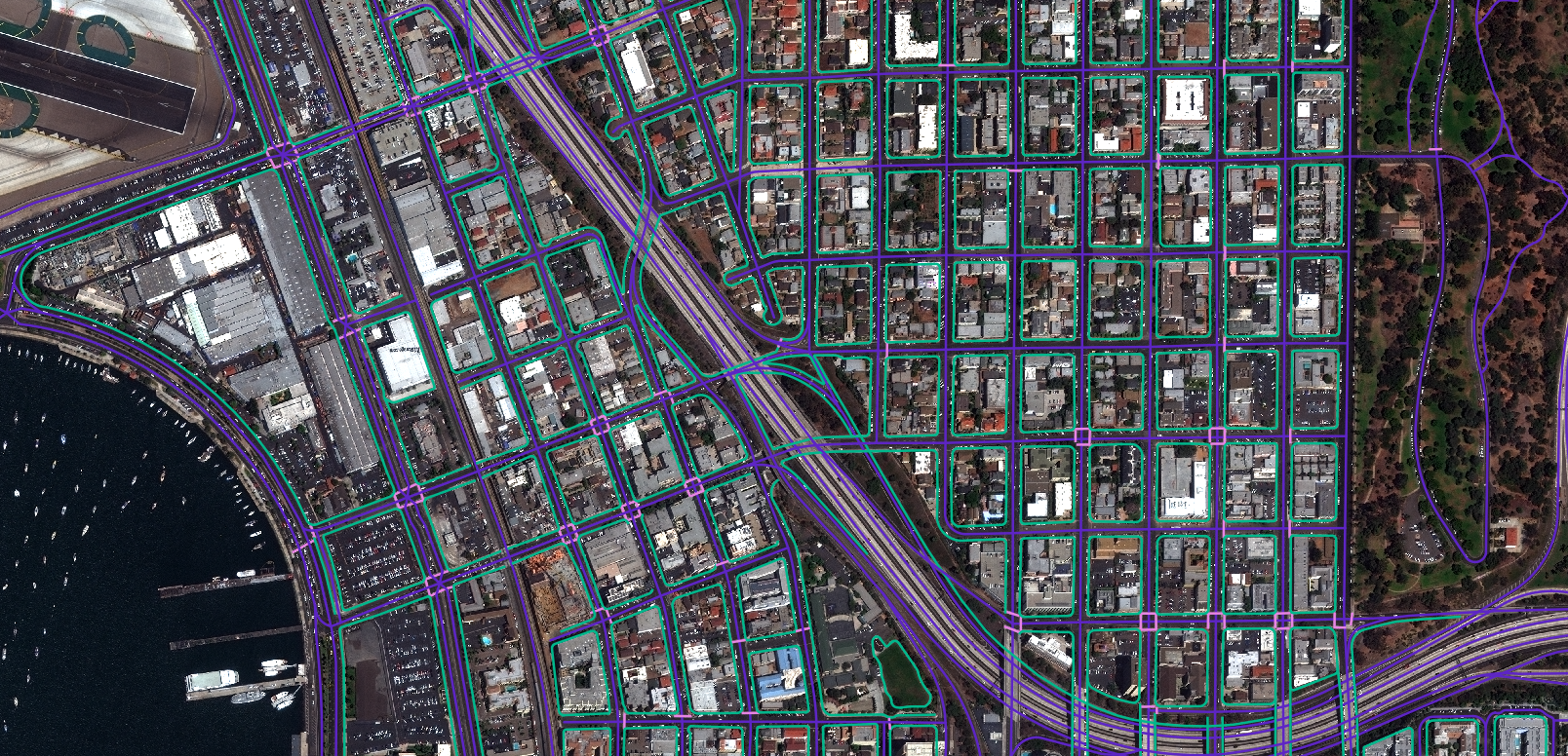 News
News
High-precision land-cover and fuel mapping to support wildfire mitigation and response across the European Union.
Read more → Case studies
Road markings classified by type, checked for occlusion and graded for physical quality — at scale.
Read more → Case studies
Road-surface damage and texture classified across Bruges from satellite and panchromatic imagery — condition surveying without the drive-around.
Read more →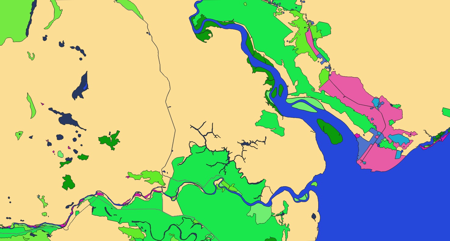 Datasets
A high-resolution, satellite-derived vector dataset of Moscow with exceptional detail in infrastructure and assets.
Read more → Projects
A computer-vision dataset that sorts buildings into 35+ types — the backbone for insurance, planning and risk analytics.
Read more →Send us your area of interest and what you need to see. We'll return a sample over your own location and walk you through the platform.