Germany · 2025 · 30 cm → 7.5 cm
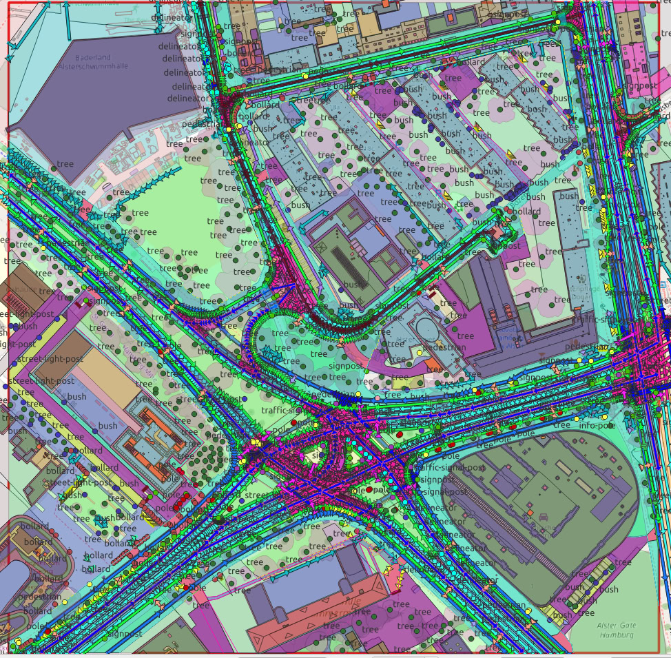
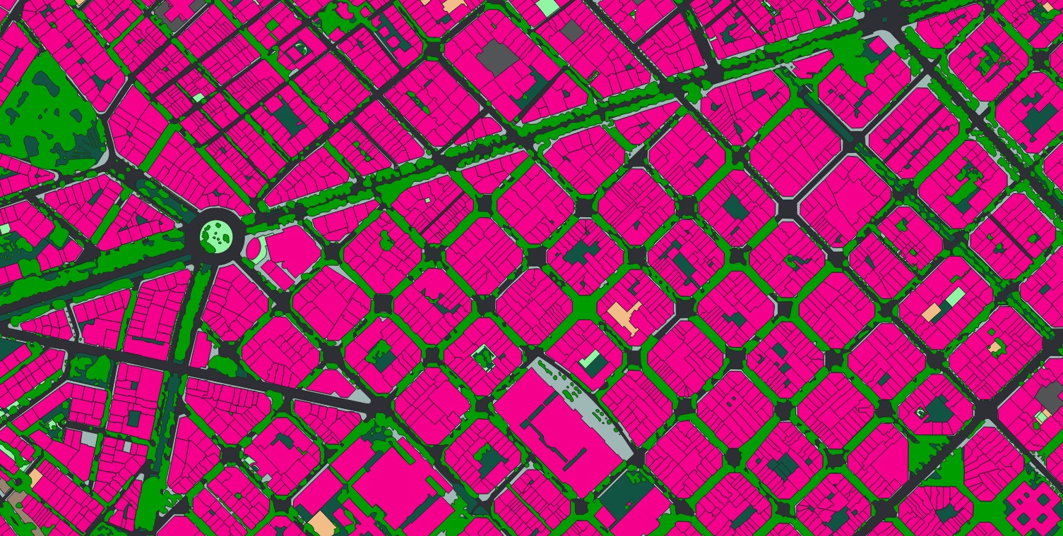
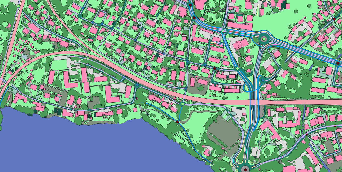
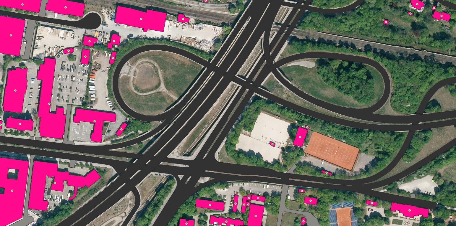
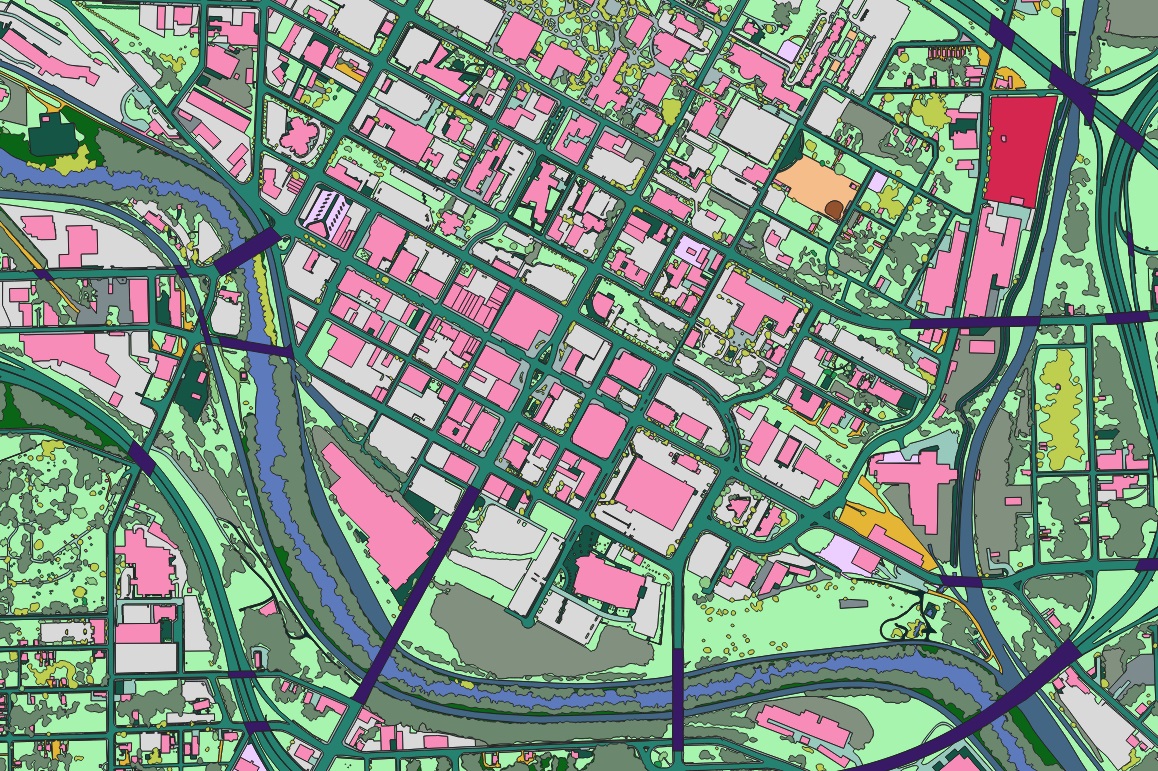
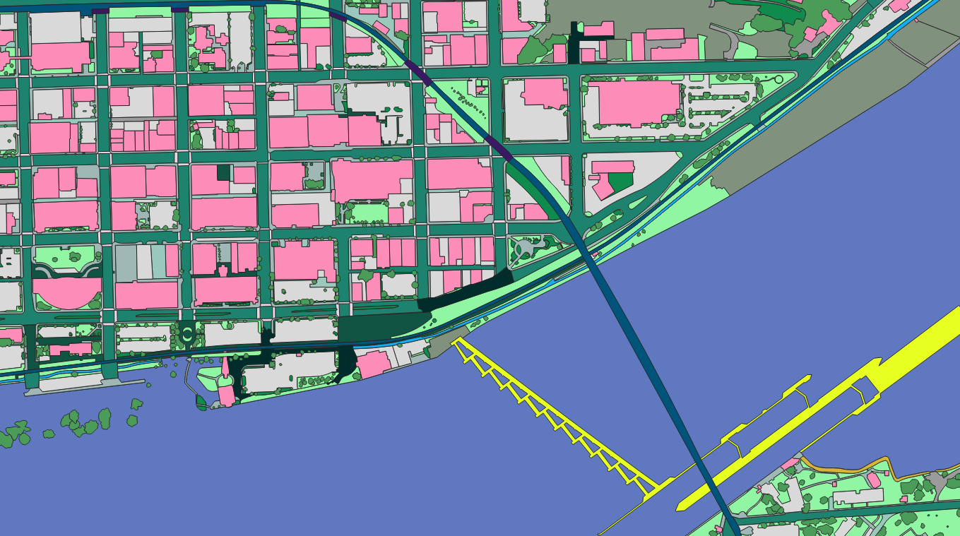
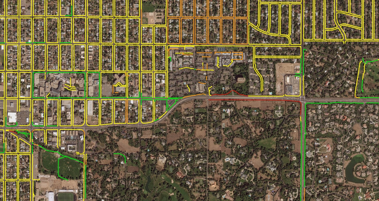
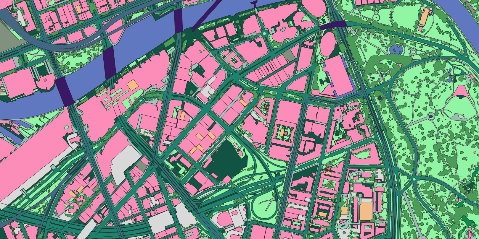
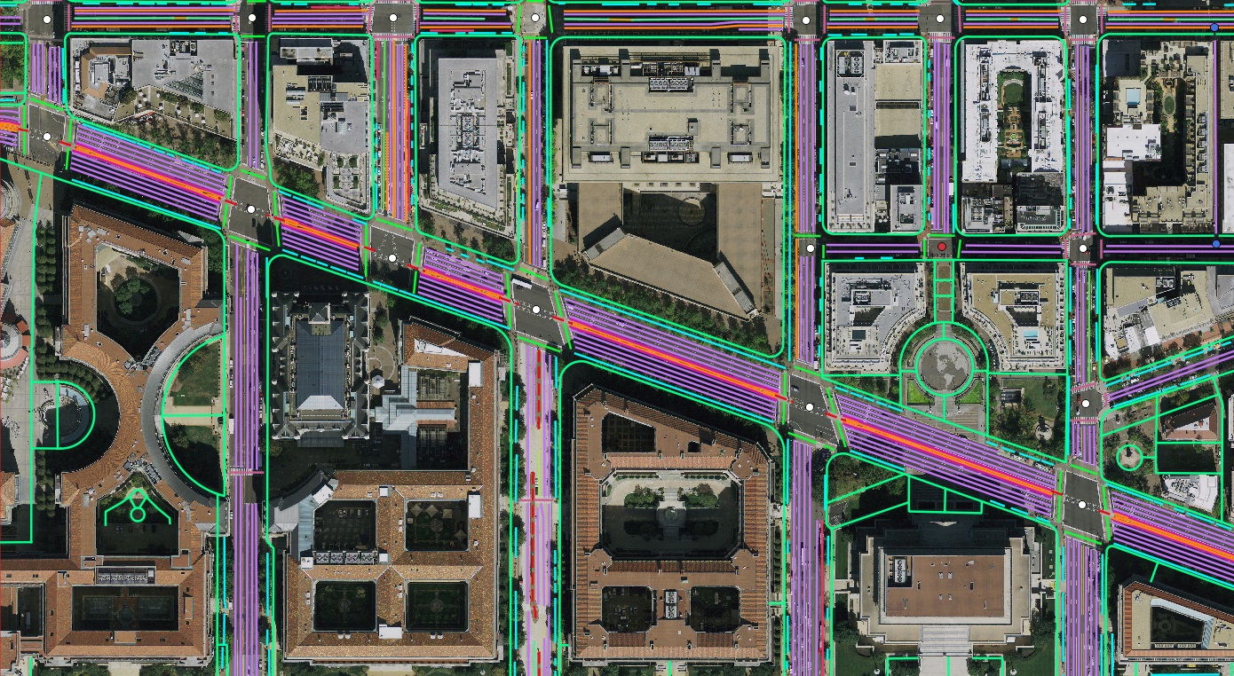
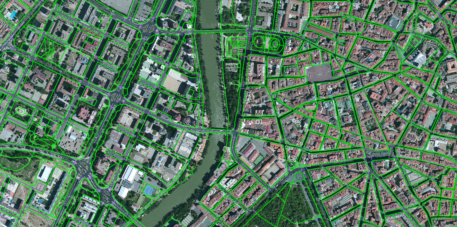
Hamburg HD mapping from tri-stereo satellite
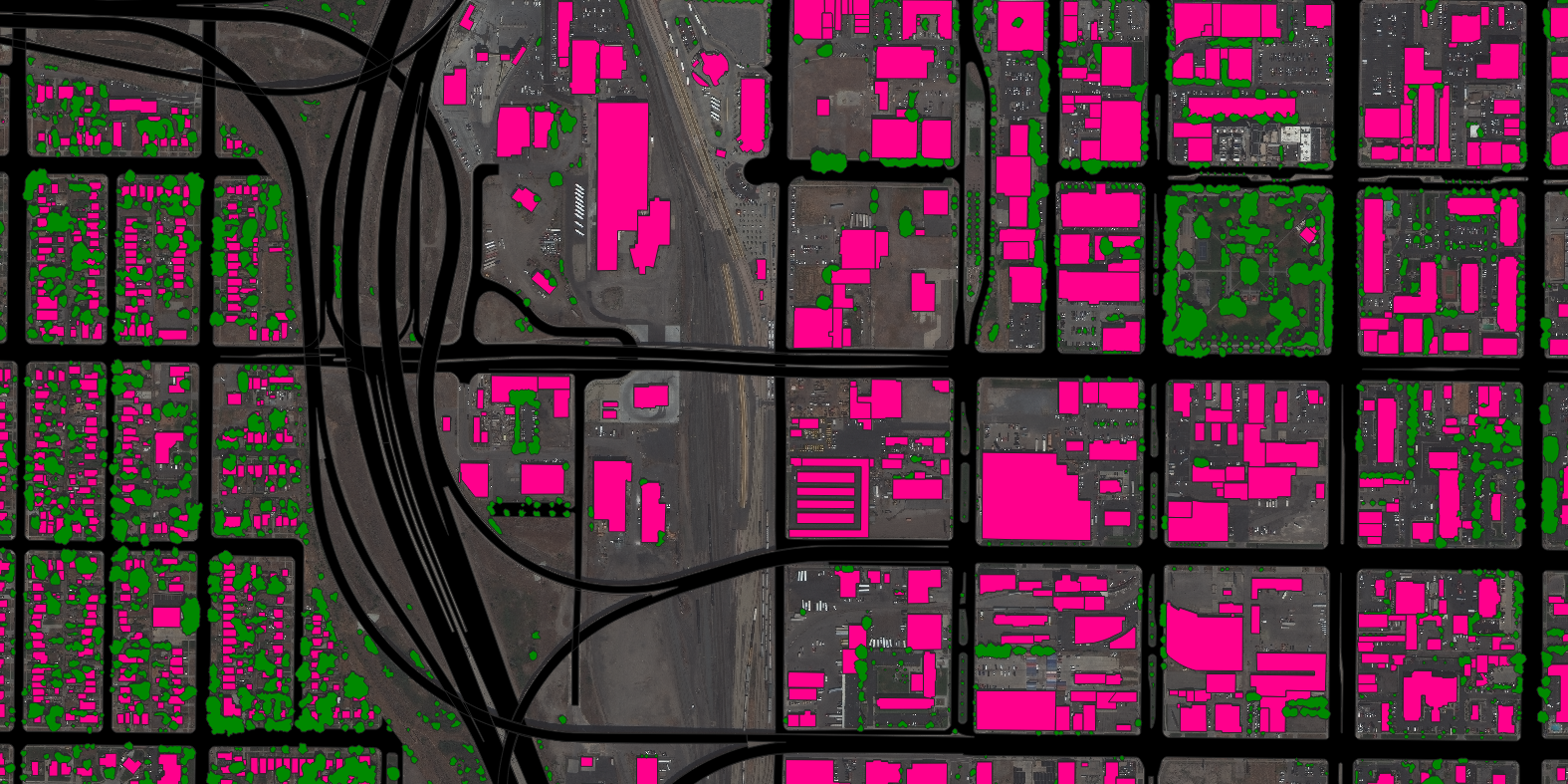
Level-1 mono/stereo/tri-stereo satellite imagery turned into a full HD vector map and 3D city model for a mobility partner.
Around 70 projects across six continents and every sensor — optical, SAR, thermal, hyperspectral, panchromatic and multispectral, from 500 m down to 1 mm. A selection below.
Level-1 mono/stereo/tri-stereo satellite imagery turned into a full HD vector map and 3D city model for a mobility partner.

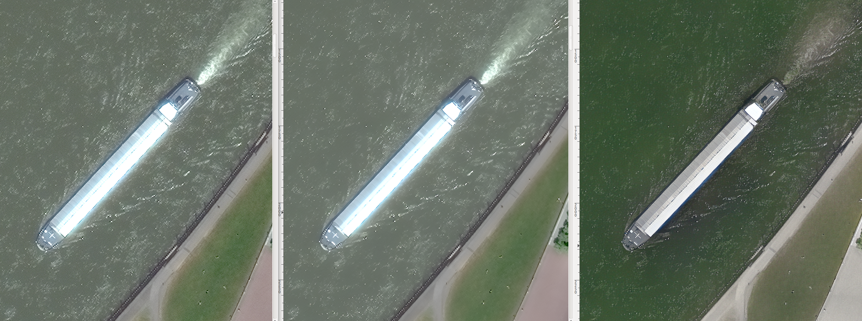
Proprietary AI super-resolution enhances native 30 cm satellite imagery to aerial-grade detail without a new flight.

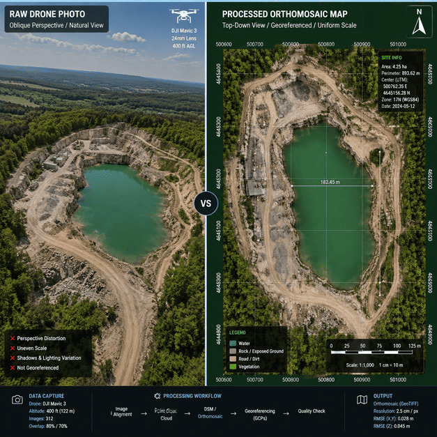
Extreme-factor super-resolution recovers ground detail from coarse airborne imagery, validated against a 5 cm reference.
2× super-resolution of orthorectified WorldView imagery over Munich for map-ready clarity.
SAR–optical sensor fusion removes cloud and night gaps and flags real change with high consistency.
Centimetre-level ground control points localised remotely via SAR–optical fusion, no field survey required.
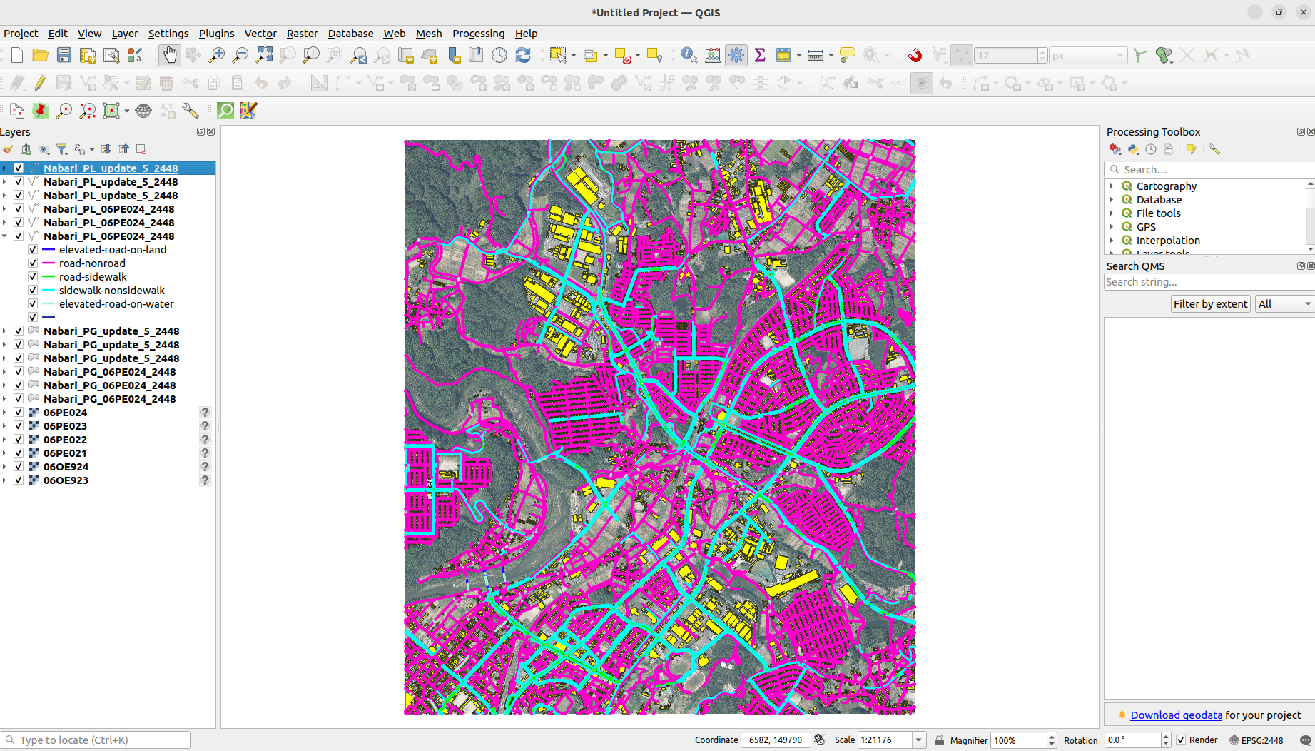
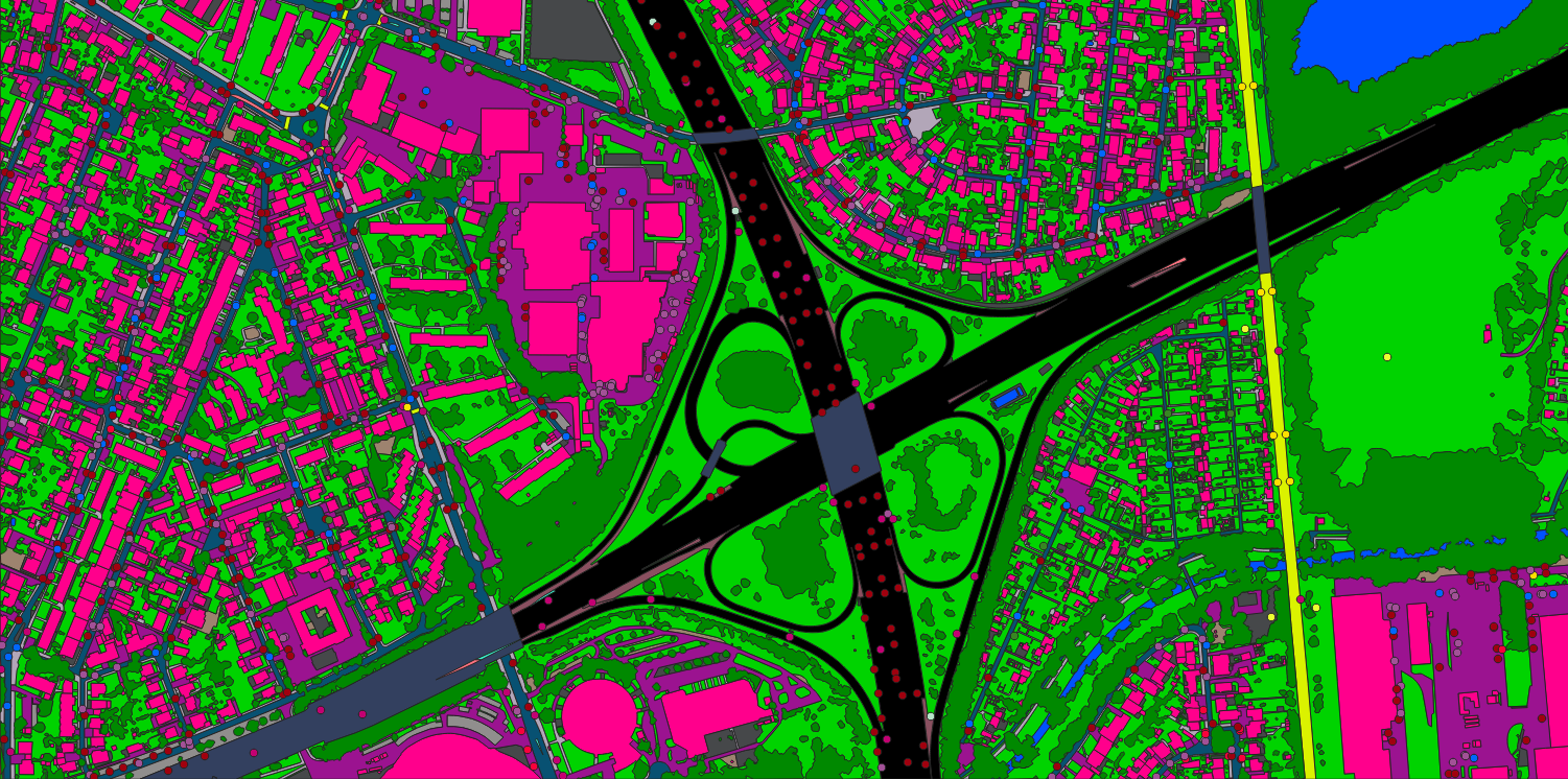
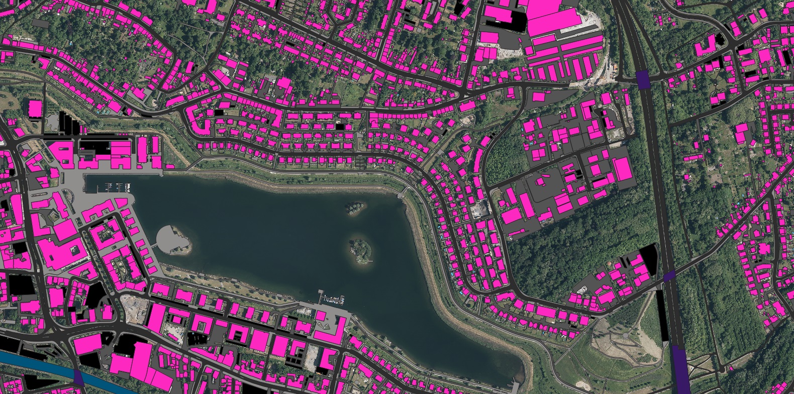
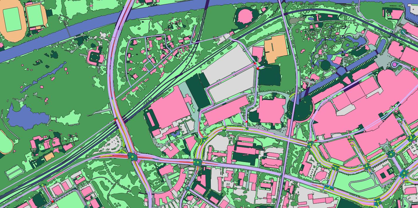
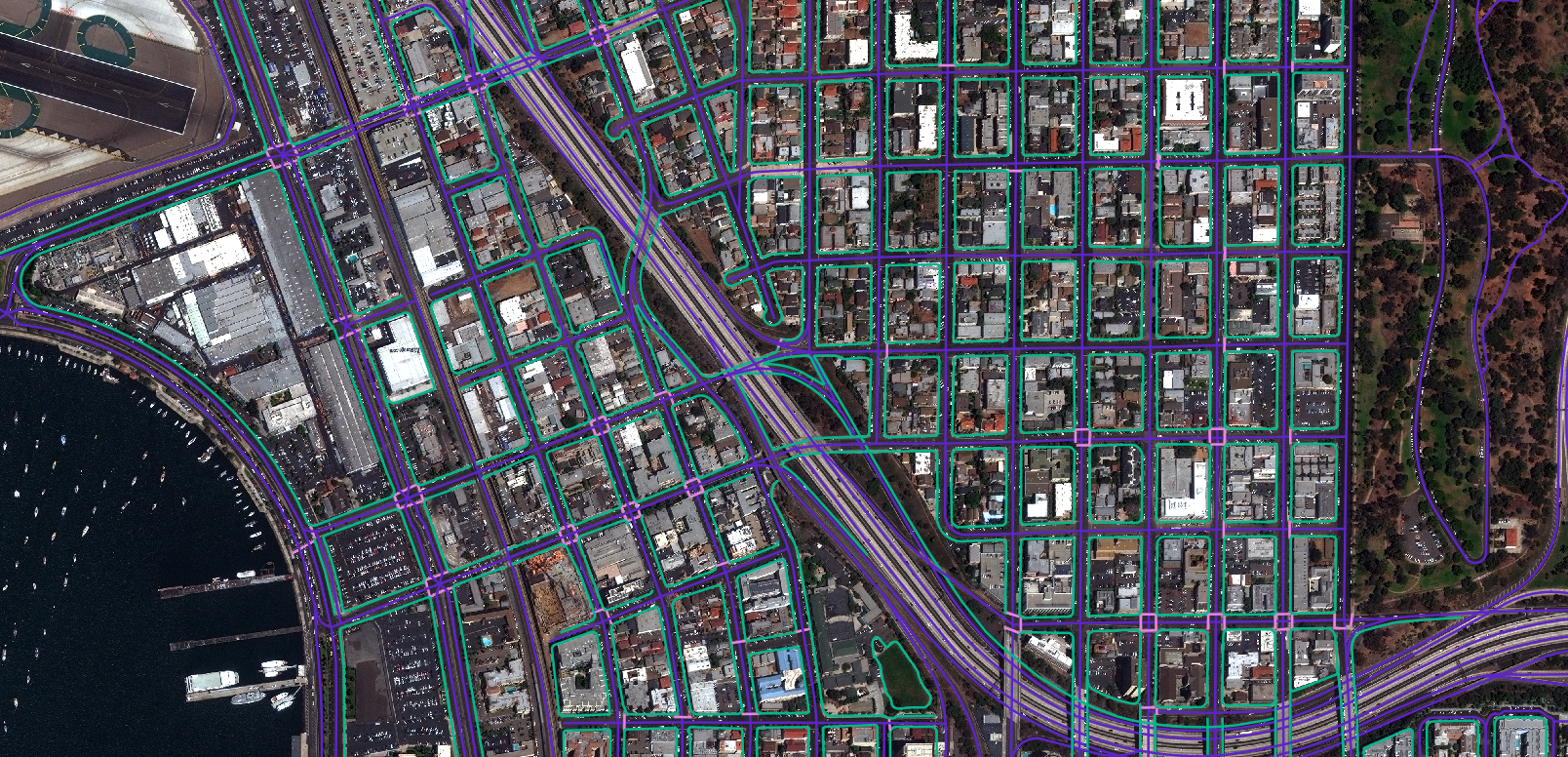
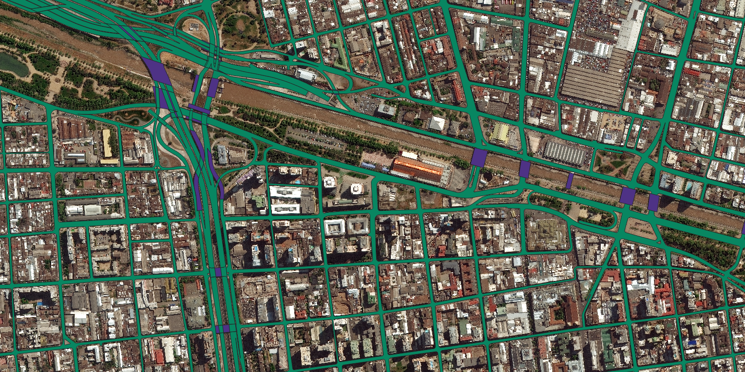
Directly vectorized HD maps generated at a fraction of the time and cost of conventional methods.
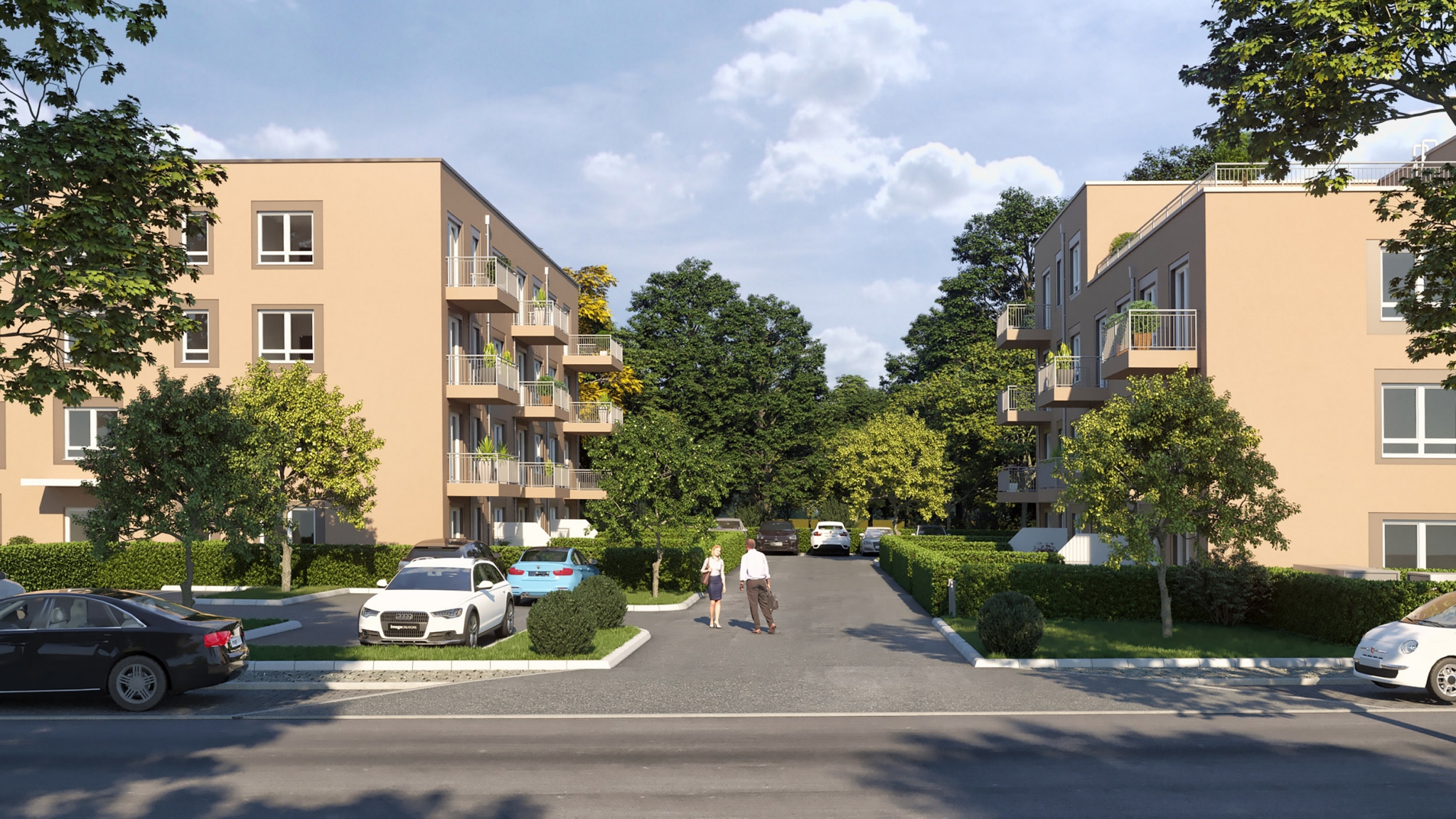
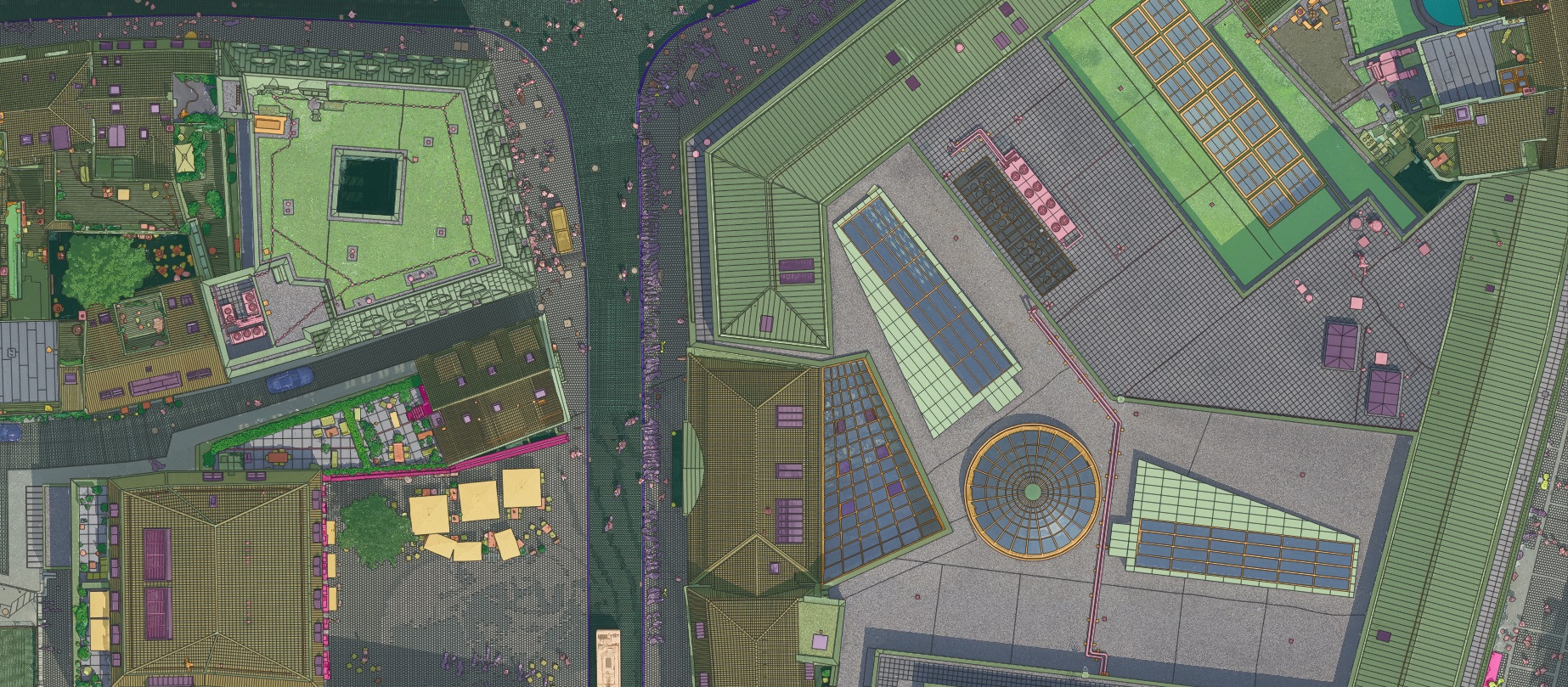
A Hamburg intersection taken all the way to a navigable, photoreal Unreal-engine digital twin.
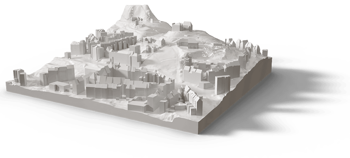
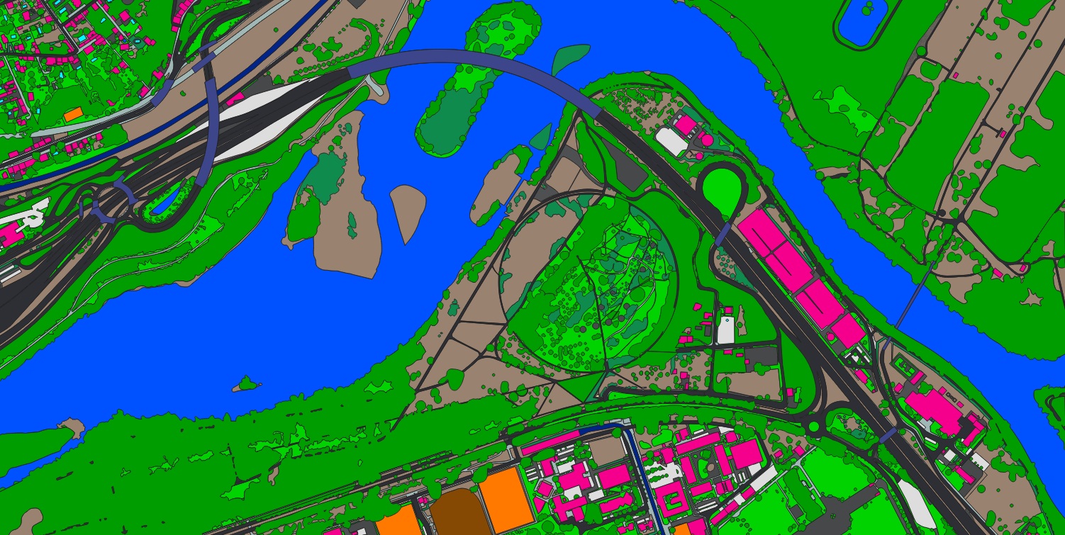
Photogrammetric mesh and CityGML model of Aachen for planning and visualisation.
High-resolution photogrammetric reconstruction of central Lille.

Repeat capture, AI inspection and change alerts along transmission and transport corridors.

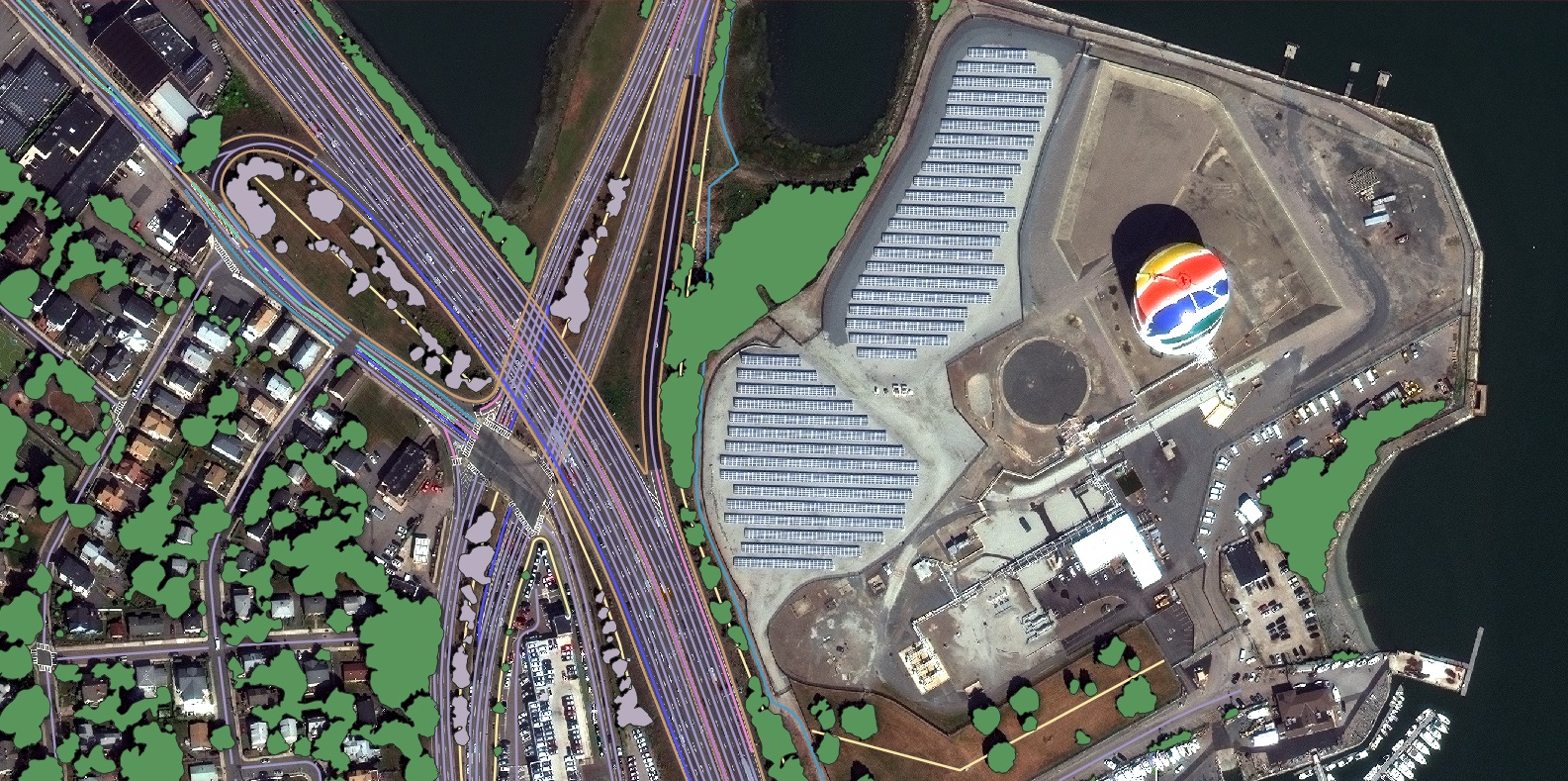
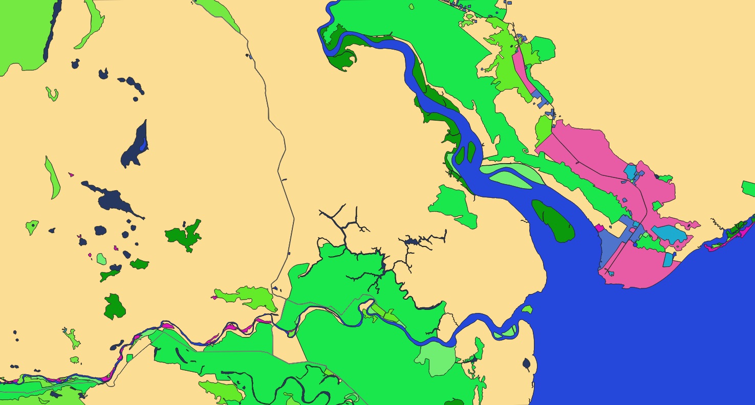
Coastlines, ports, ships, offshore wind and oil & gas platforms — mapped and monitored at the surface.
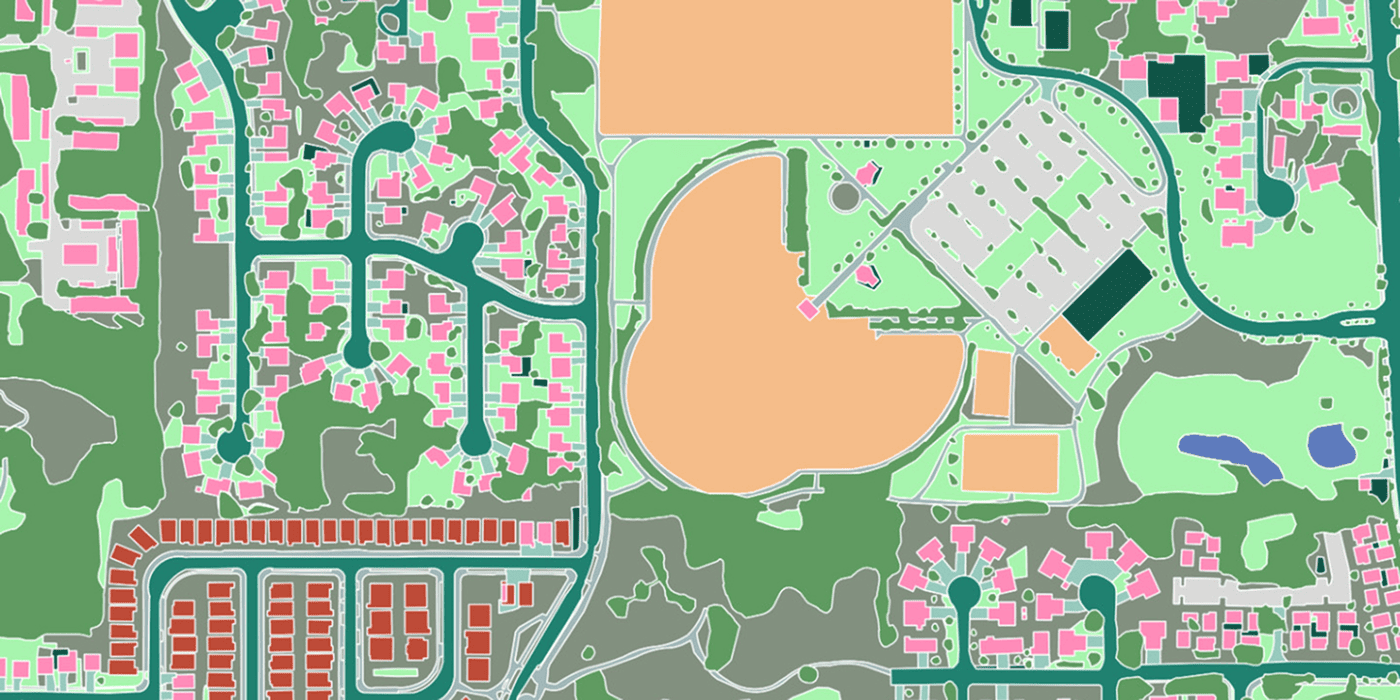
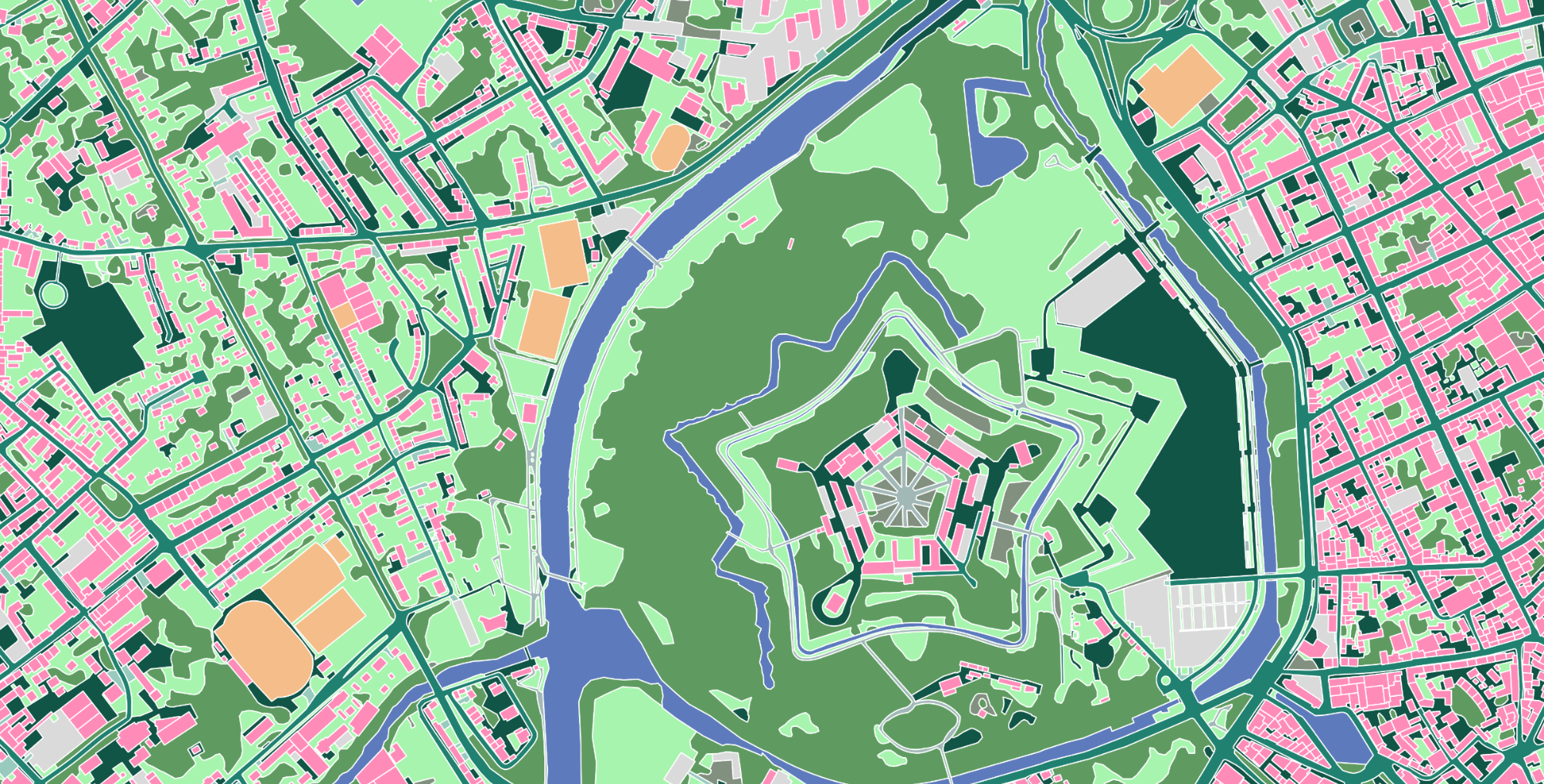
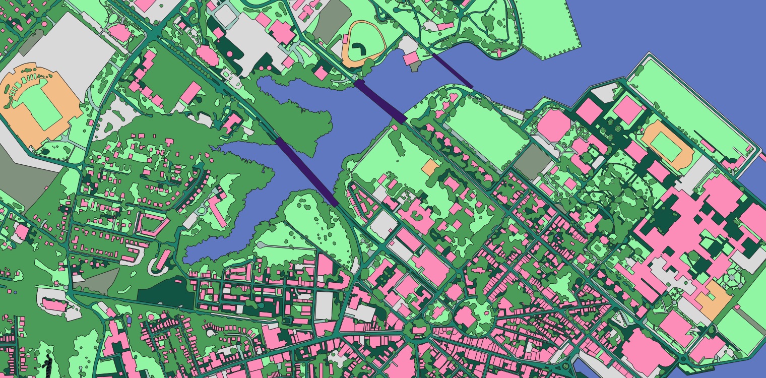
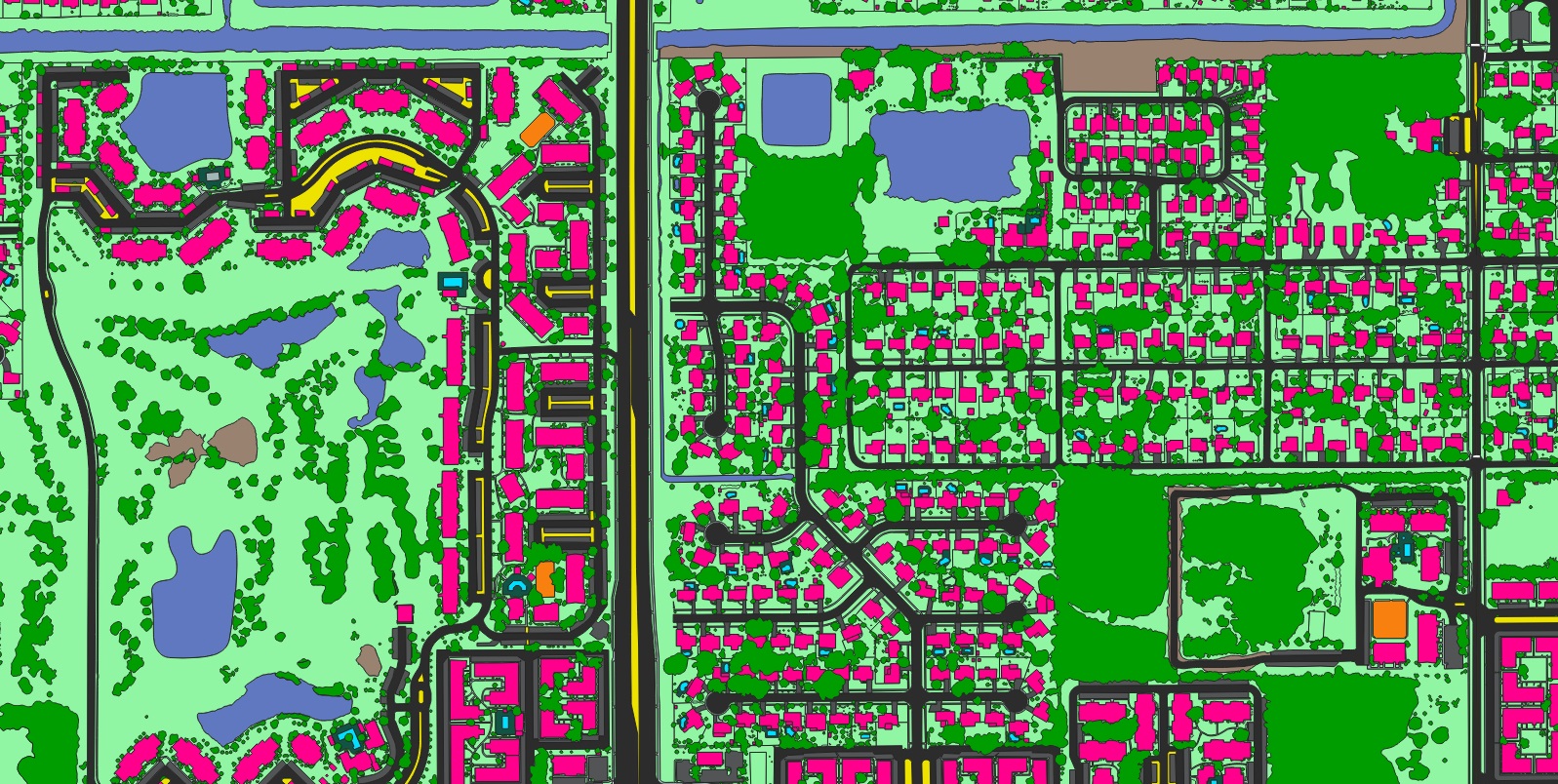
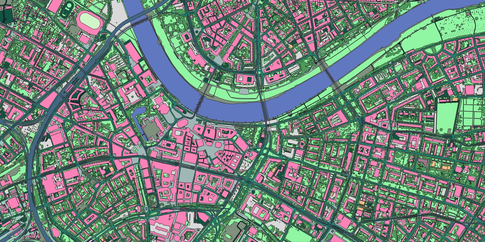
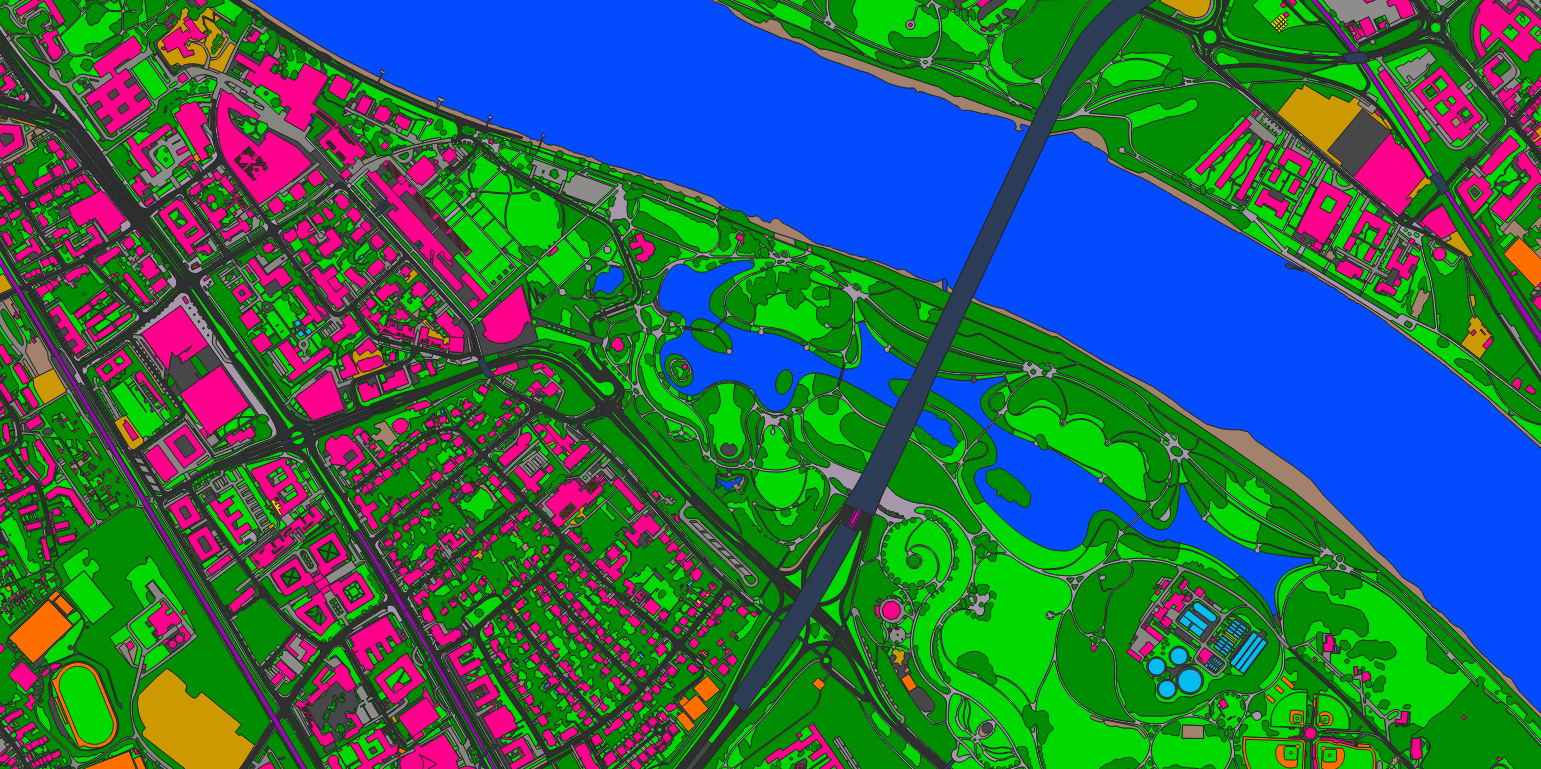
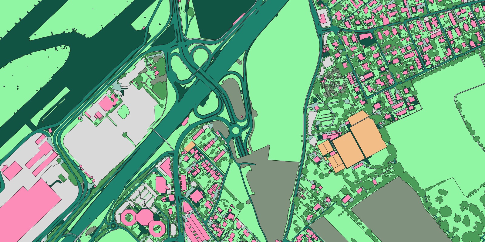
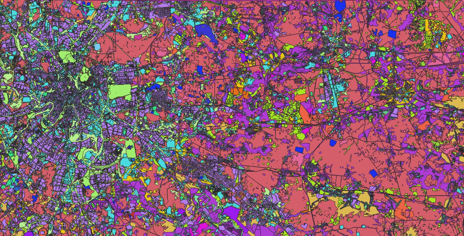
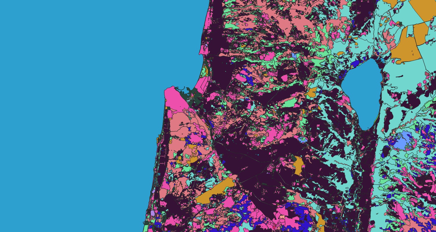
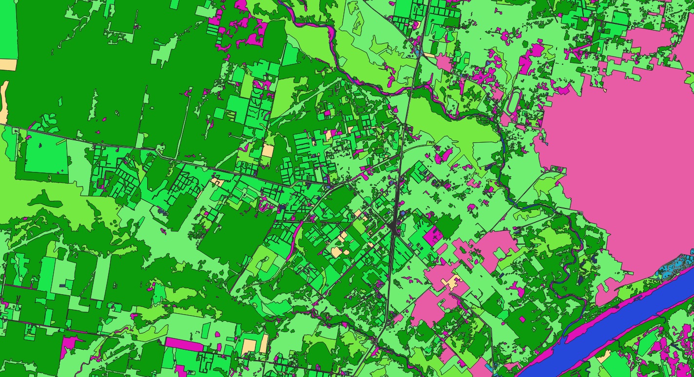
Wall-to-wall land-cover classification separating sealed surfaces from vegetation across the metropolitan area.
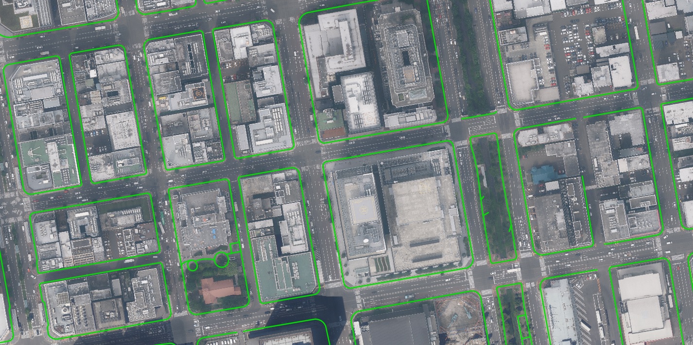
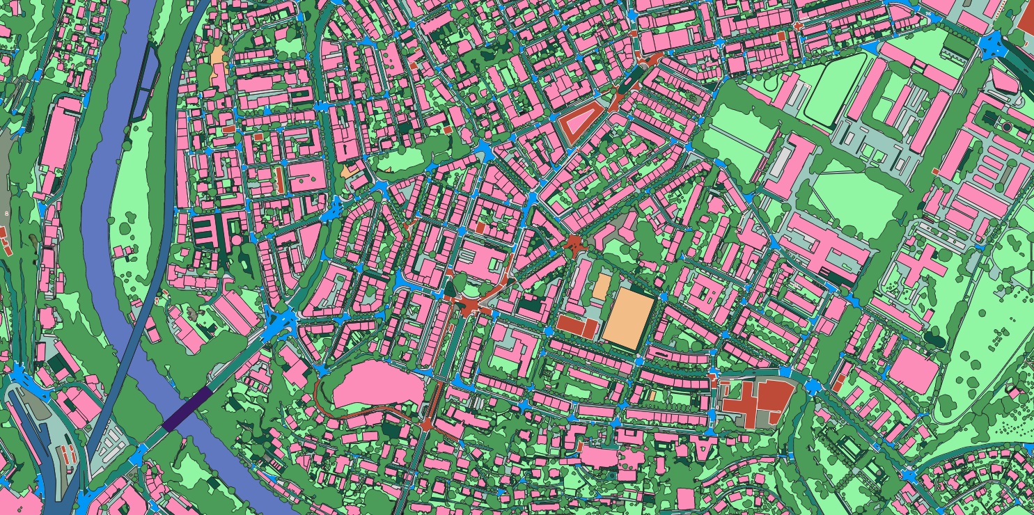
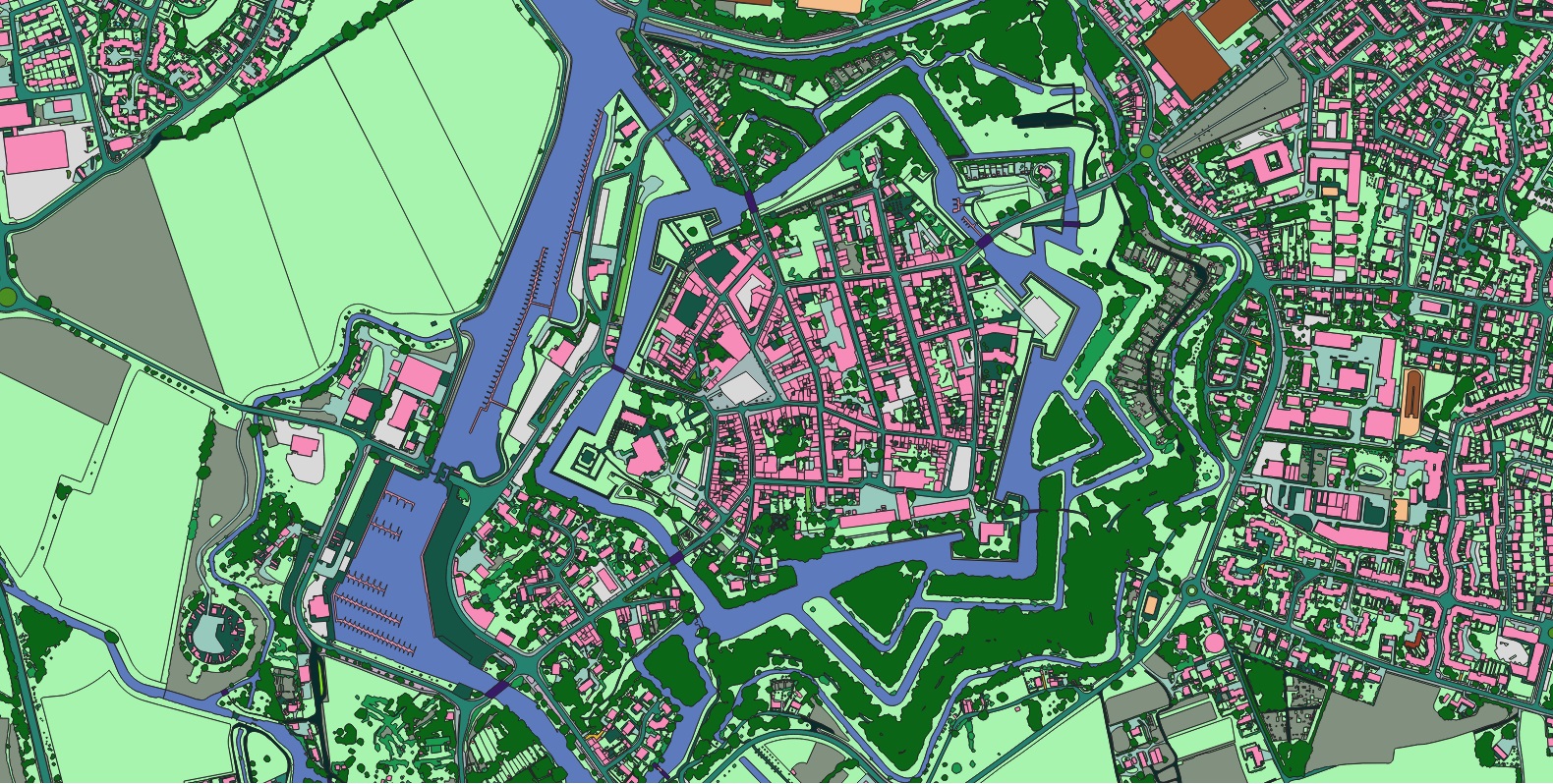
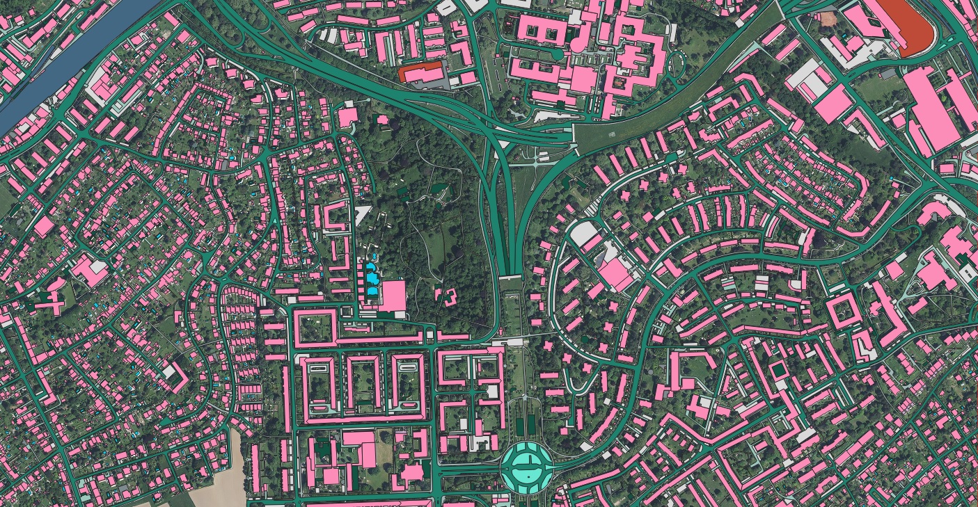
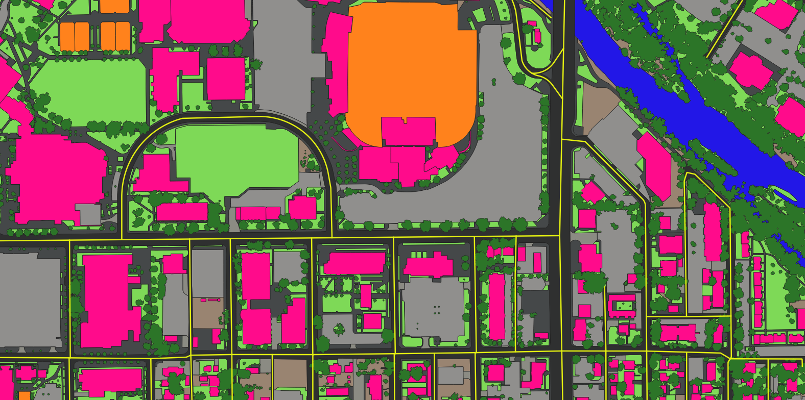
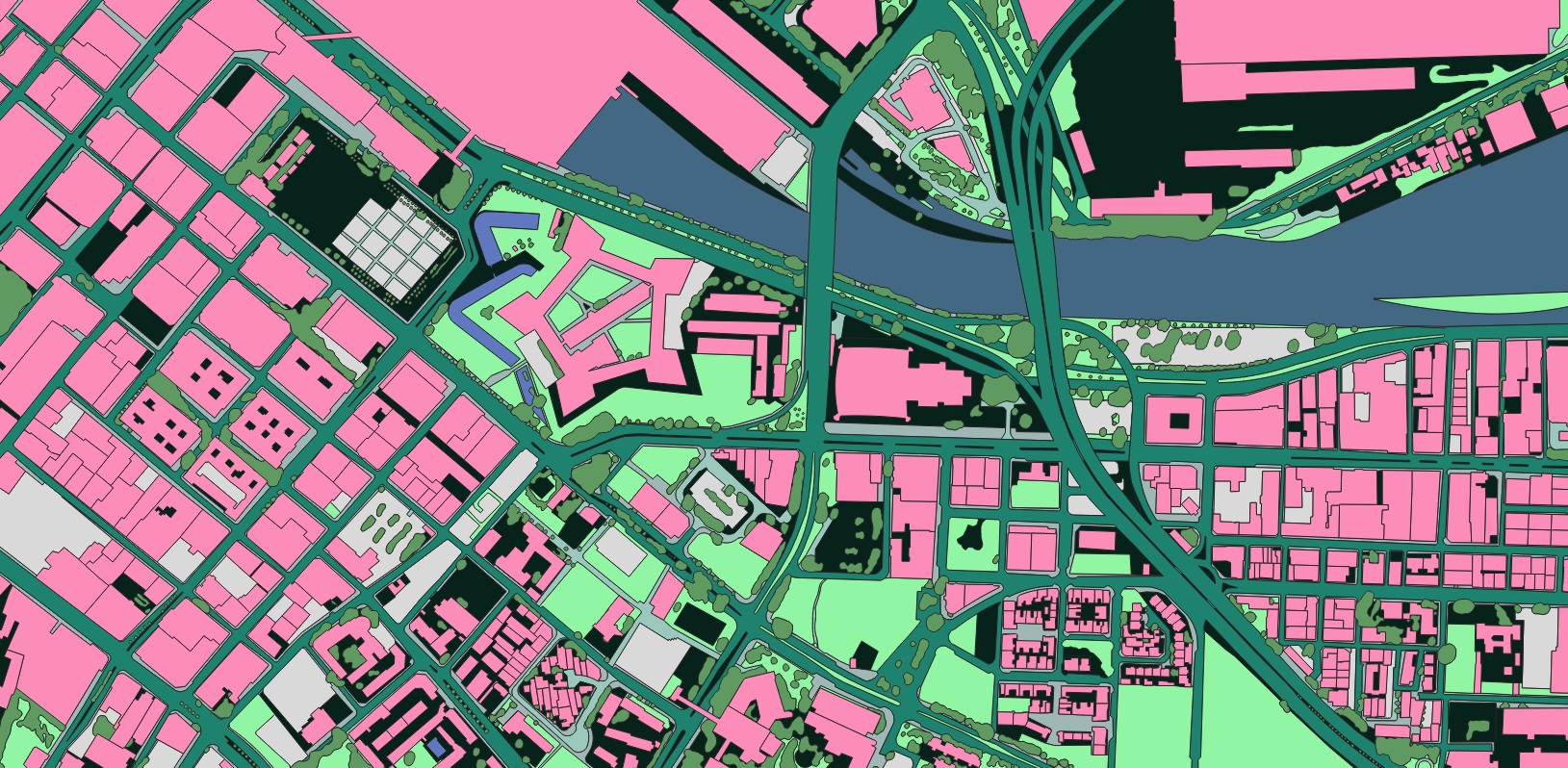
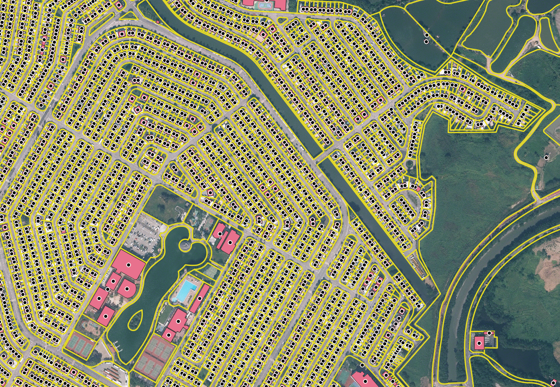
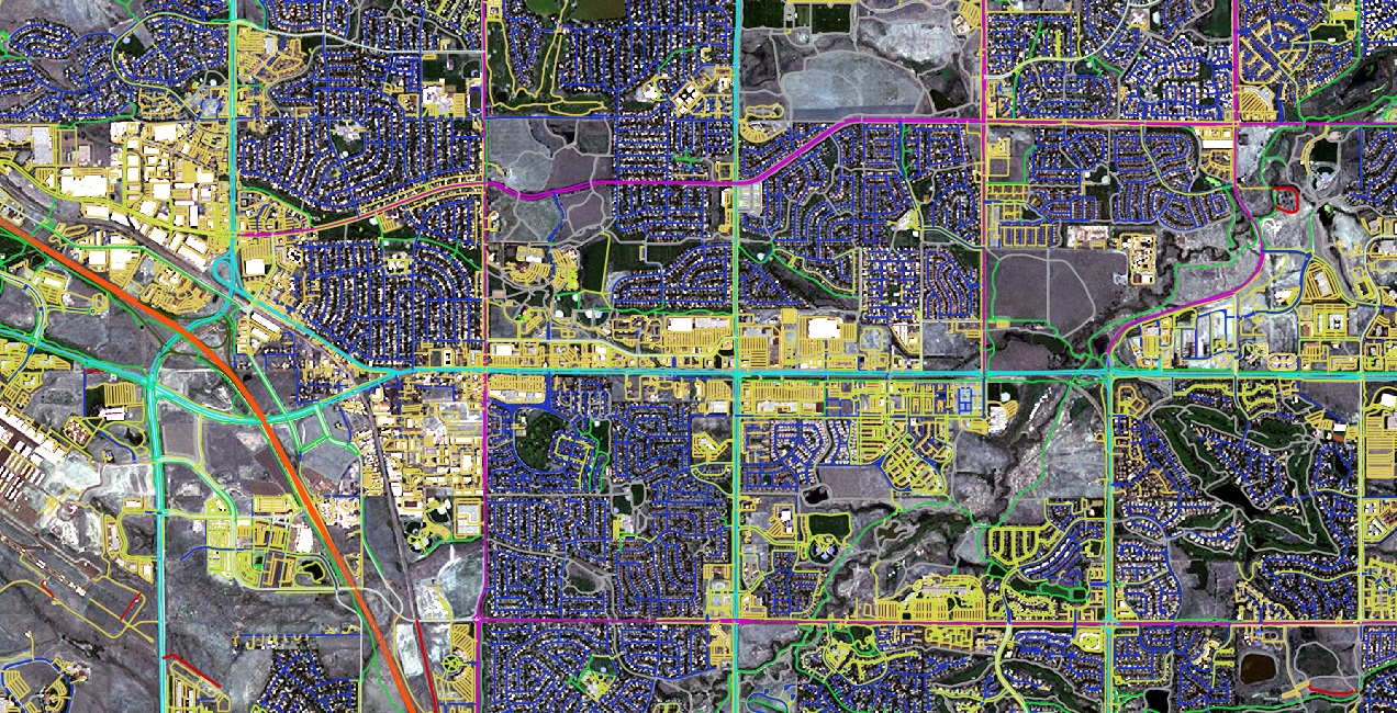
True-ortho aerial mosaic and a clean vector base map of buildings, roads and green space over central Münster.
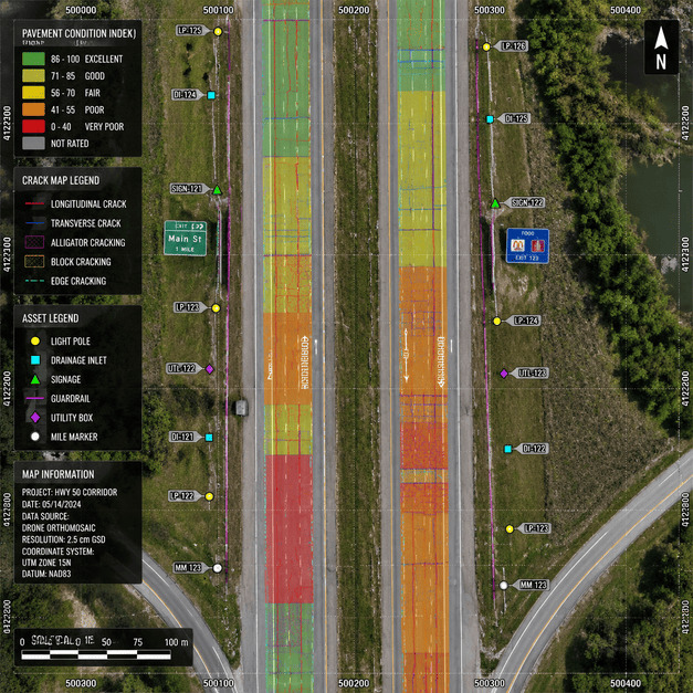
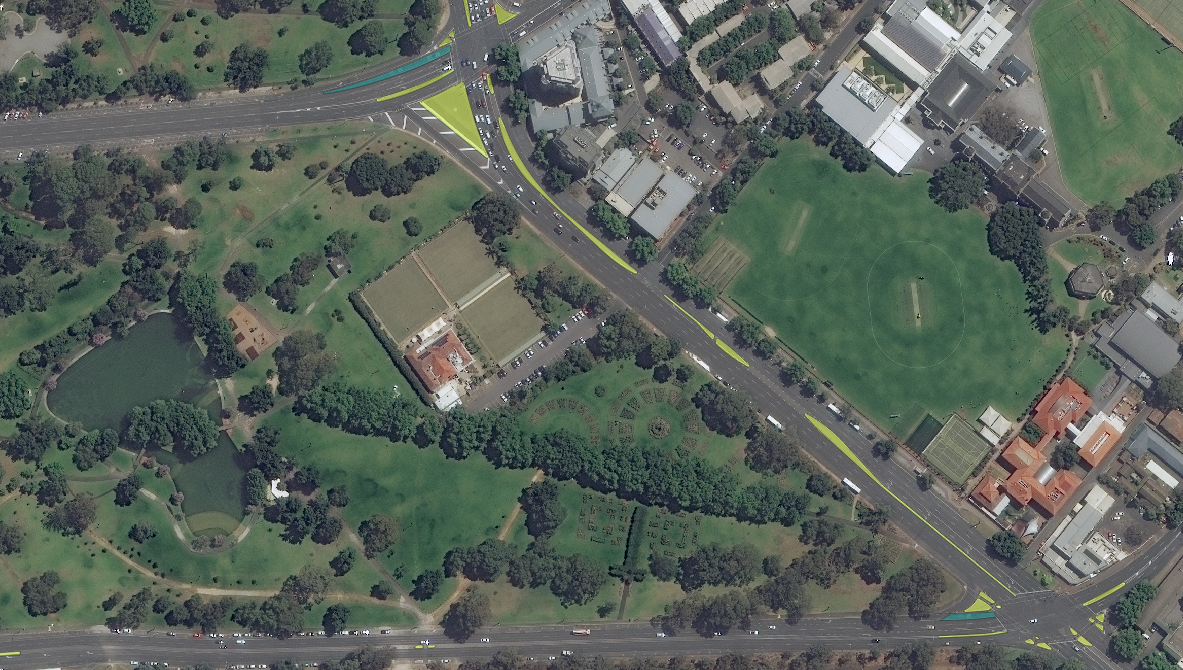
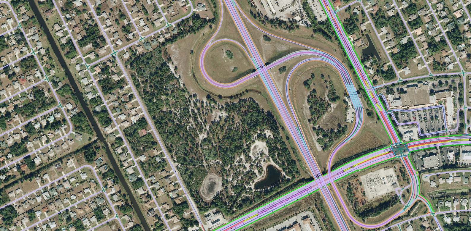
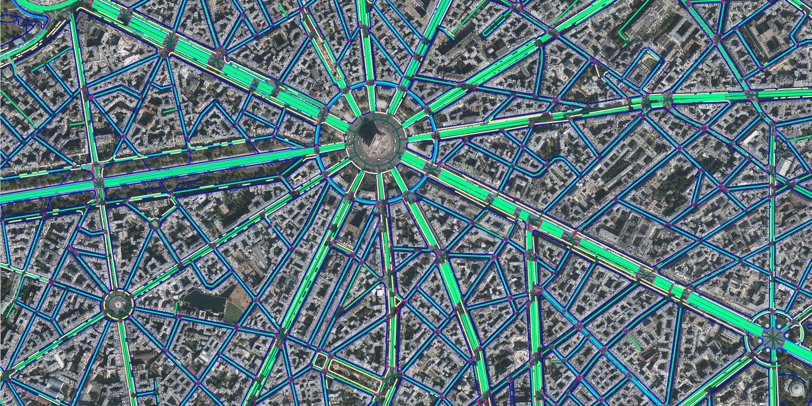
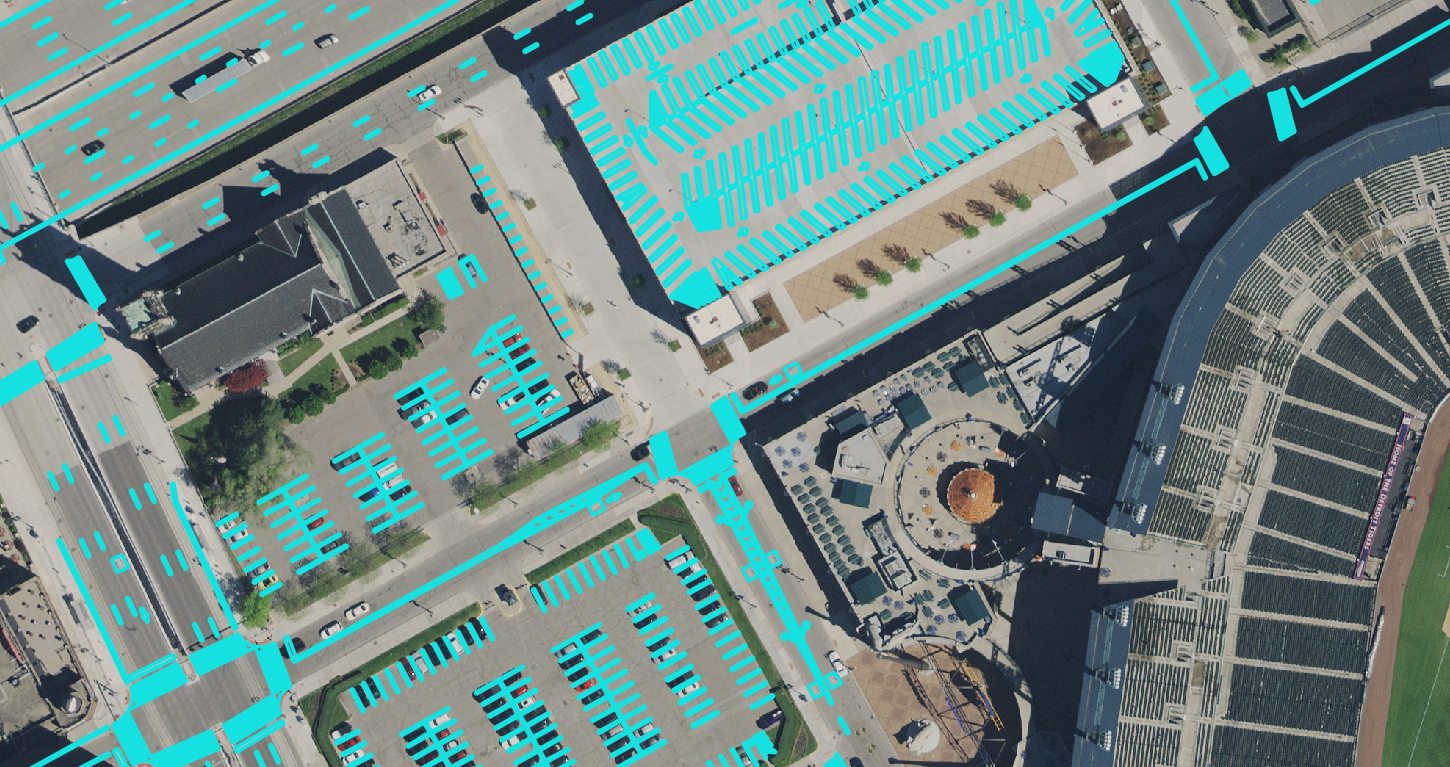
AI classification of carriageways, lane markings and surface condition from high-resolution imagery.
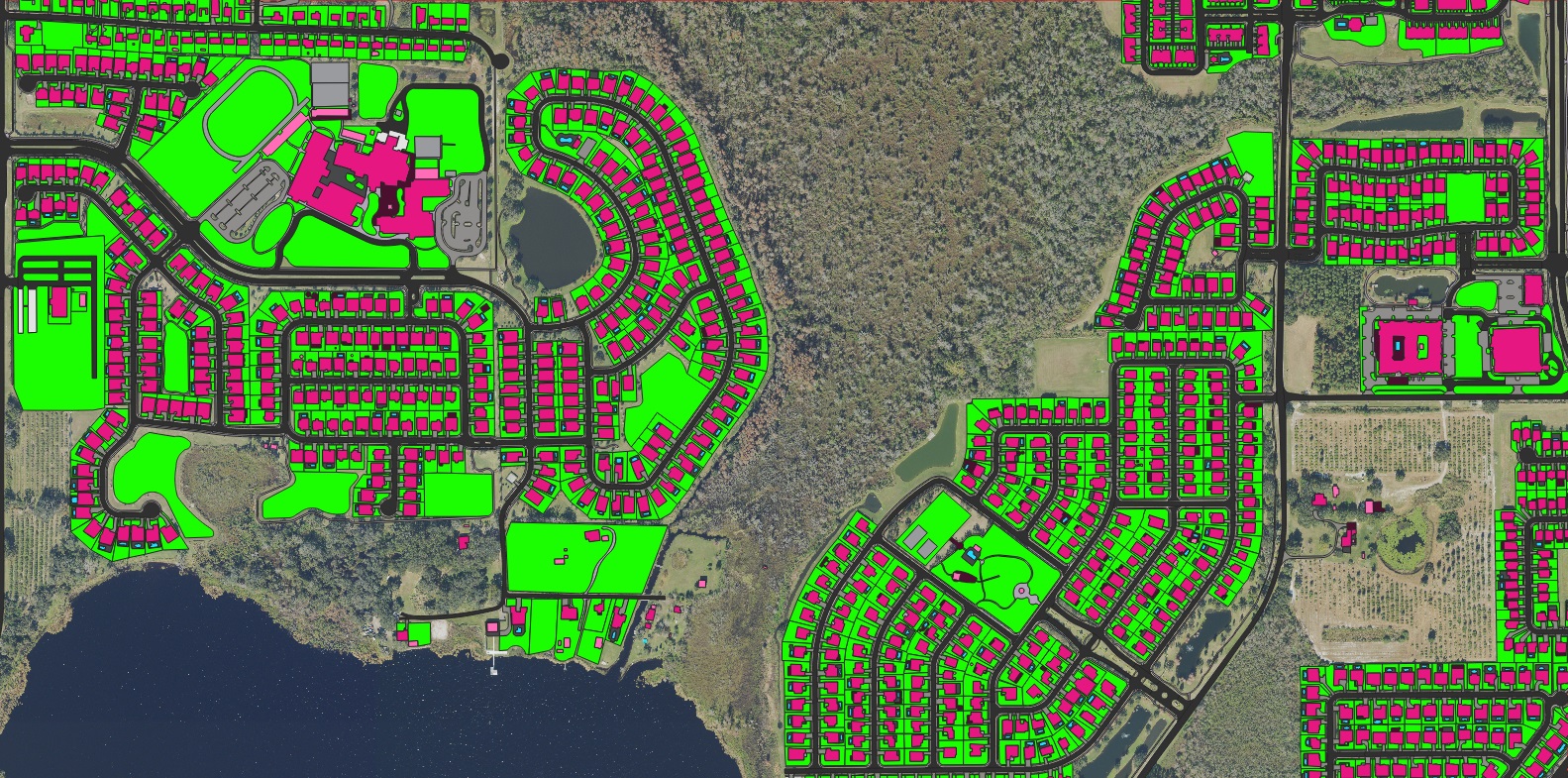
New, modified and demolished buildings flagged automatically between two image epochs.
This is a curated sample. Ask for the full portfolio →
A sample of mapping & surveying projects across six continents, from satellite to centimetre-grade aerial.

…and many more. Ask about coverage over your area →
Send us your area of interest and what you need to see. We'll return a sample over your own location and walk you through the platform.