The Digital Twin Imperative: Geoenabling Resilience, Planning, and Analytics Across Industries
Geospatial data is reshaping strategic decision-making across industries by giving every challenge a precise, location-based context. The organising idea is geoenabling — putting accurate, accessible spatial intelligence in the hands of the professionals who plan, build and protect our communities.
Climate resilience
In the face of climate change, geospatial data is pivotal to building resilience. Integrating high-quality layers — high-precision land cover among them — enables the climate analysis that helps communities understand their vulnerabilities and plan, fund and build defences for both natural and built environments.
Transportation & smart cities
For mobility and smart-city work, geospatial analytics foster safer, smarter, more sustainable communities — from optimising networks to planning sustainable growth on a foundation of high-precision data.
From data to a working twin
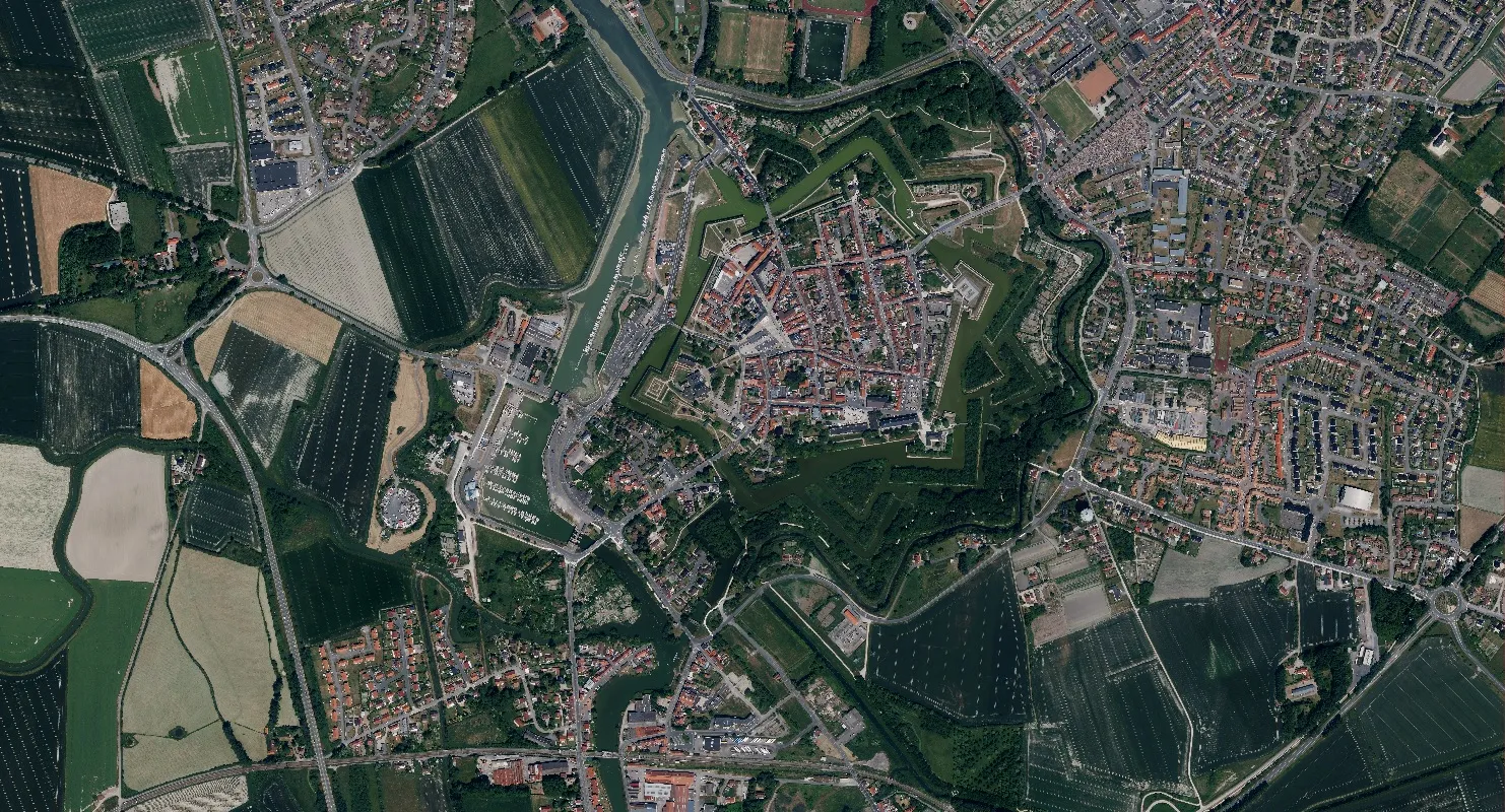
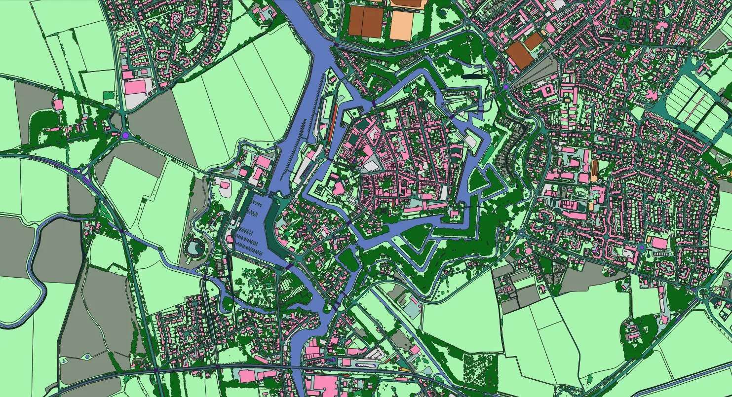
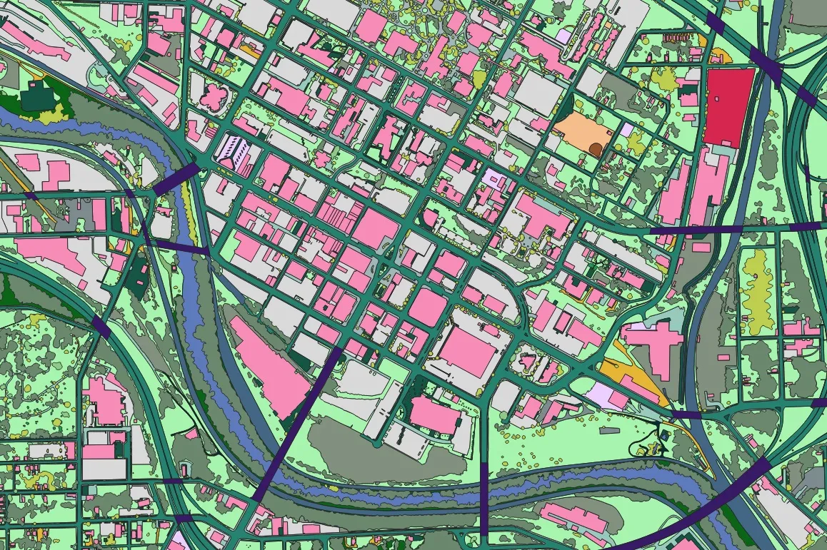
A digital twin is where this comes together. An implemented project in Gravelines, France turns geospatial data into strategic insight — modelling the city's transportation and land cover to enable traffic simulation and sustainable planning. It is geoenabling made tangible: less a nice-to-have than a prerequisite for serious planning and analysis.
Sample results
Drag the slider to compare imagery and AI output.
 ImageMapping
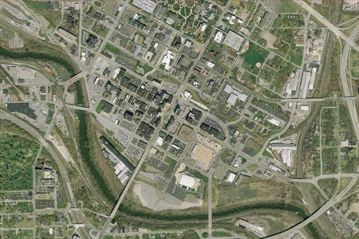
 ImageMapping

