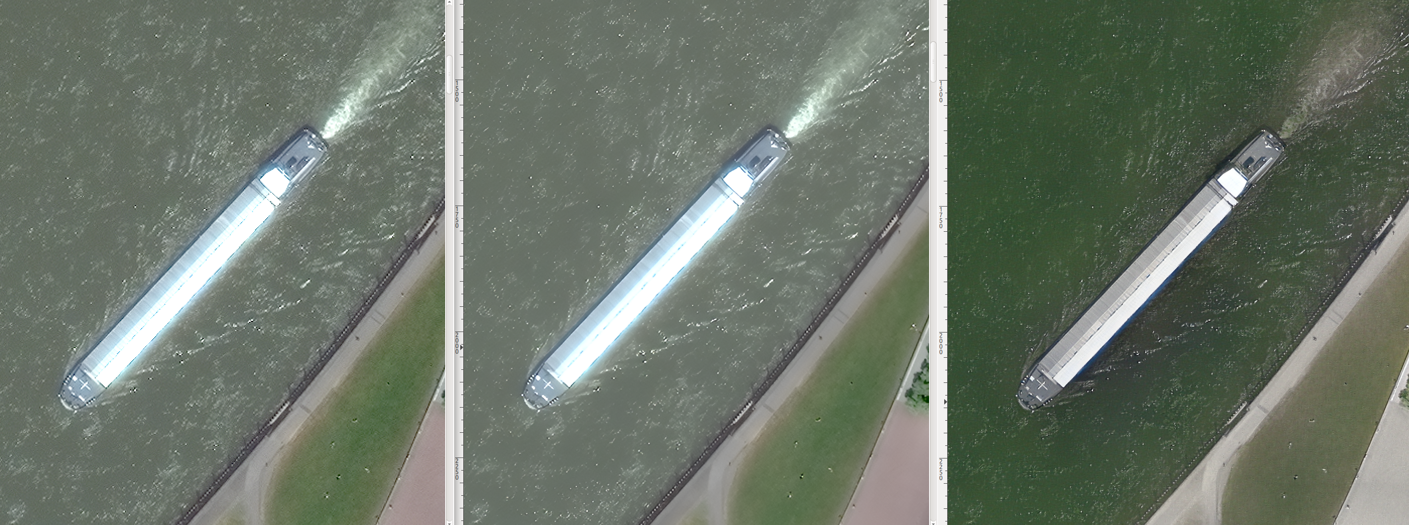
Imagery & super-resolution
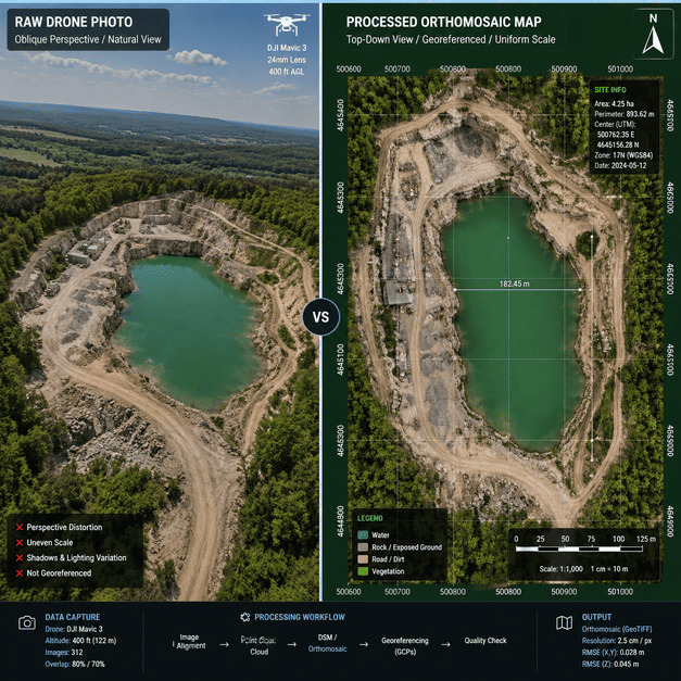
Pansharpening, single- and multi-frame super-resolution, and AI cloud removal deliver clean, sub-meter pixels — even from yesterday's hazy pass.
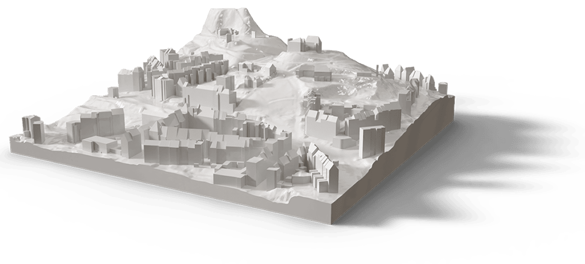
TwinSphere fuses satellite, aerial and ground survey into a continuously-updated 4D twin. TrueHD super-resolution, AI feature extraction & change monitoring, survey-grade 2D/3D/SD/HD maps, CityGML models and real-time simulation — backed by fast worldwide imagery, fresh tasking or archive. One source of truth, sensor to decision.
Optical, SAR, thermal, hyperspectral, multispectral and pan — fresh tasking or archive, anywhere on Earth, quoted fast.
Get imagery →AI 2D/3D mapping, photogrammetry, change monitoring, CityGML, WebGIS and real-time simulation.
Explore the platform →A competence spin-off of CHORA — supported by leading space & innovation programmes
Work down through every capability, from satellite imagery to a simulation-ready 4D twin. Want the proof? Open the sample results for any service — our real outputs over a single intersection, the same area at every step.


Task fresh satellite imagery over your area of interest — optical, multispectral, hyperspectral, thermal or SAR — or pull it from archive.
Stop stitching together a dozen vendors. TwinSphere owns the full chain — so geometry, semantics and 3D all reference the same ground truth.
New or archive tasking — satellite, aerial, drone & in-situ; optical, multispectral, thermal, SAR & LiDAR.
Pansharpening, super-resolution, cloud removal, atmospheric & geometry correction.
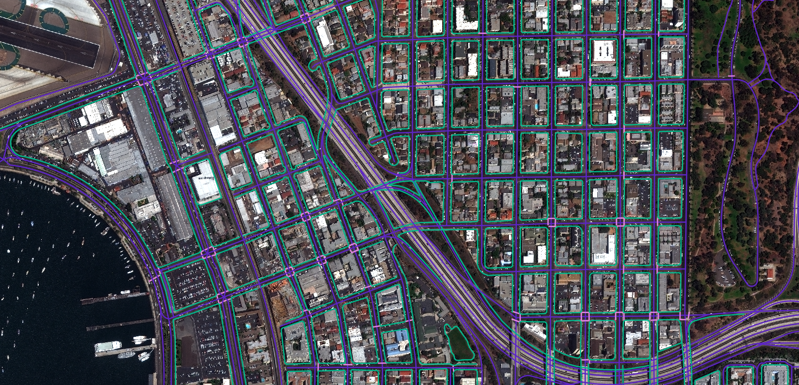
Segmentation, object detection & tracking, change detection, LLM insight.
True/normal ortho, DSM/DTM, mesh, point cloud, CityGML, OBJ/FBX, SD & HD maps.
Web-based 3D WebGIS, Unreal Engine, simulation, VR/XR and the geospatial metaverse.
Pansharpening, single- and multi-frame super-resolution, and AI cloud removal deliver clean, sub-meter pixels — even from yesterday's hazy pass.
Semantic, instance and panoptic segmentation produce clean vector layers — building footprints, lane-level roads, land use — at country scale.
Order new captures or search archive. Lock an AOI for periodic imaging with automatic change notifications, the moment something appears.
True & normal ortho, DSM, DTM, dense point clouds, textured mesh, CityGML and OBJ/FBX — survey-grade and georeferenced.
Lane-accurate HD maps, SD navigation networks and OpenDRIVE exports for autonomy, ADAS validation and mobility planning.
Serve the twin from a web-based 3D WebGIS, or stream it to Unreal Engine, VR/XR and a navigable geospatial metaverse.
We're sensor- and source-agnostic. Whatever your area of interest needs, we task it, fuse it, and register it into a single model.

Optical, multispectral, hyperspectral, thermal and SAR — sub-meter to wide-area, new tasking or archive.

Crewed aircraft and UAS — high-resolution oblique & nadir imagery, thermal, and airborne LiDAR.

Mobile mapping & street-level imagery, terrestrial LiDAR, GNSS/RTK survey, ground control and IoT sensors.

Coastlines, ports & ships, offshore wind farms and oil & gas platforms — mapped, modelled and simulated at the surface from optical, thermal & SAR.
Our reference sample takes one area from a raw satellite pass all the way to a realistic, simulation-ready 4D digital twin — the same workflow we run for an entire city.

No closed-source dependencies. Our own engines for 3D streaming, AI mapping and natural-language geospatial Q&A — book a demo to explore them with real data.
Stream city-scale 3D Tiles and vector layers — self-hosted, no Cesium/Google dependency.
OGC services (WMS/WMTS/WFS) and a 2.5D viewer embedded right here.
Natural-language geospatial insight over your AOI, powered by our LLM/GIS.
Embed slots ready — drop in the live iframes/players when the public demos are online.
Tell us about your area of interest and what you need to see. We'll send a sample over your own location and walk you through the platform.