HD vector maps
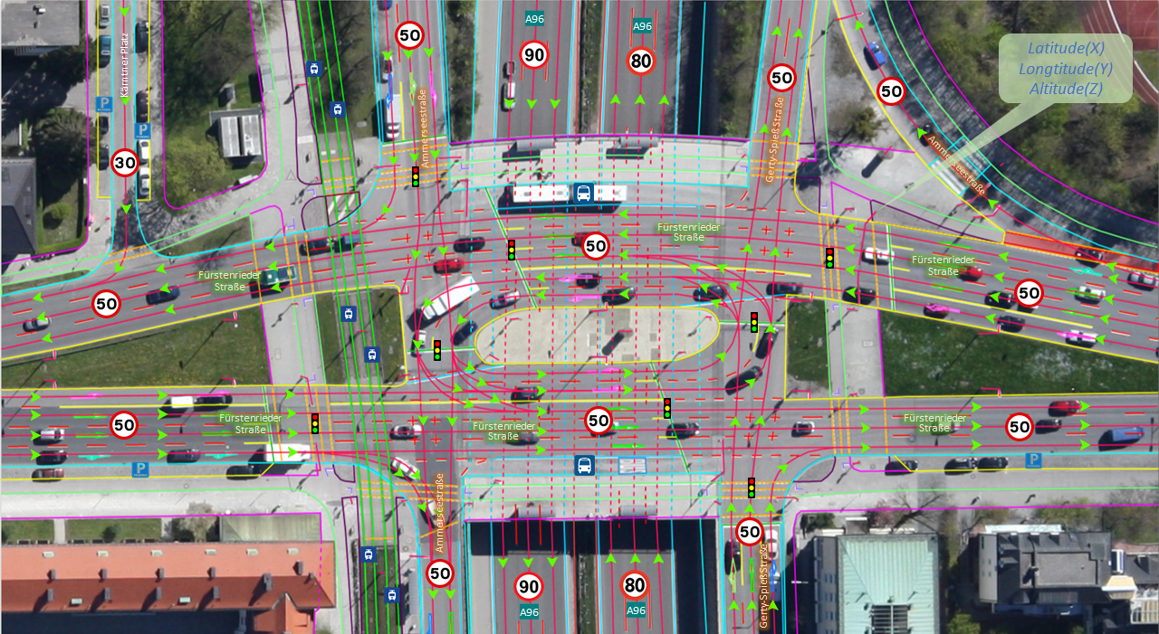
Lane-accurate road networks, markings and traffic signs, exported to ASAM OpenDRIVE for ADAS validation and driving simulation.
A new class of cube satellite paired with 15+ proprietary AI methods, built to deliver aerial-grade detail — lane-level HD maps and semantic 3D city models — at the scale and cadence only satellites can reach.

Mapping has always forced a trade-off. Terrestrial and airborne surveys give you exquisite detail, but they're costly, slow and never quite current. Optical satellites scale effortlessly across whole countries — but have stopped short of the lane-level detail that HD maps and digital twins demand.
OrbitHD is built to close that gap: a compact satellite design and a stack of proprietary AI — super-resolution, sensor fusion, cloud and shadow removal, direct vectorisation — that lifts spaceborne imagery to the detail level you used to need an aircraft for.
Every product is map-ready and open — directly vectorised, so it needs only a fraction of the data and manual effort of a conventional pipeline.
Lane-accurate road networks, markings and traffic signs, exported to ASAM OpenDRIVE for ADAS validation and driving simulation.
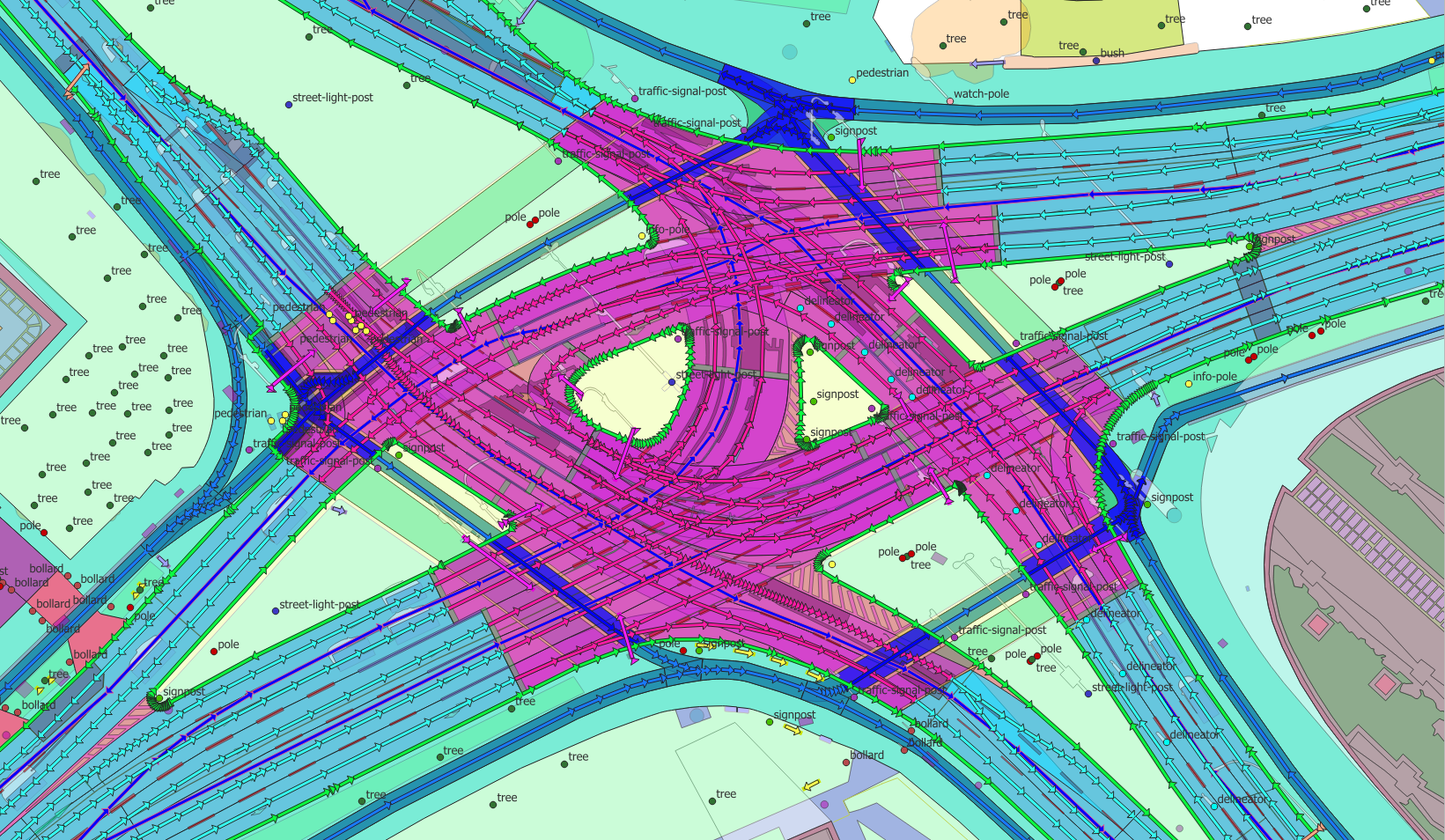
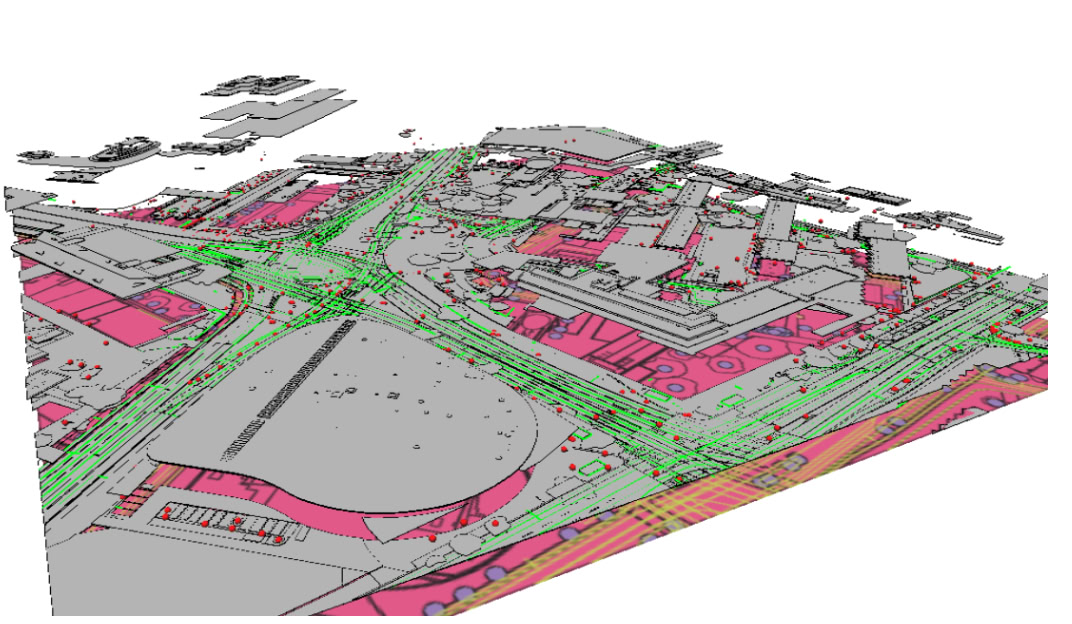
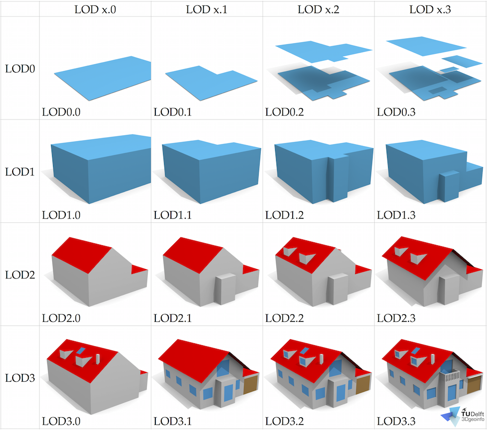
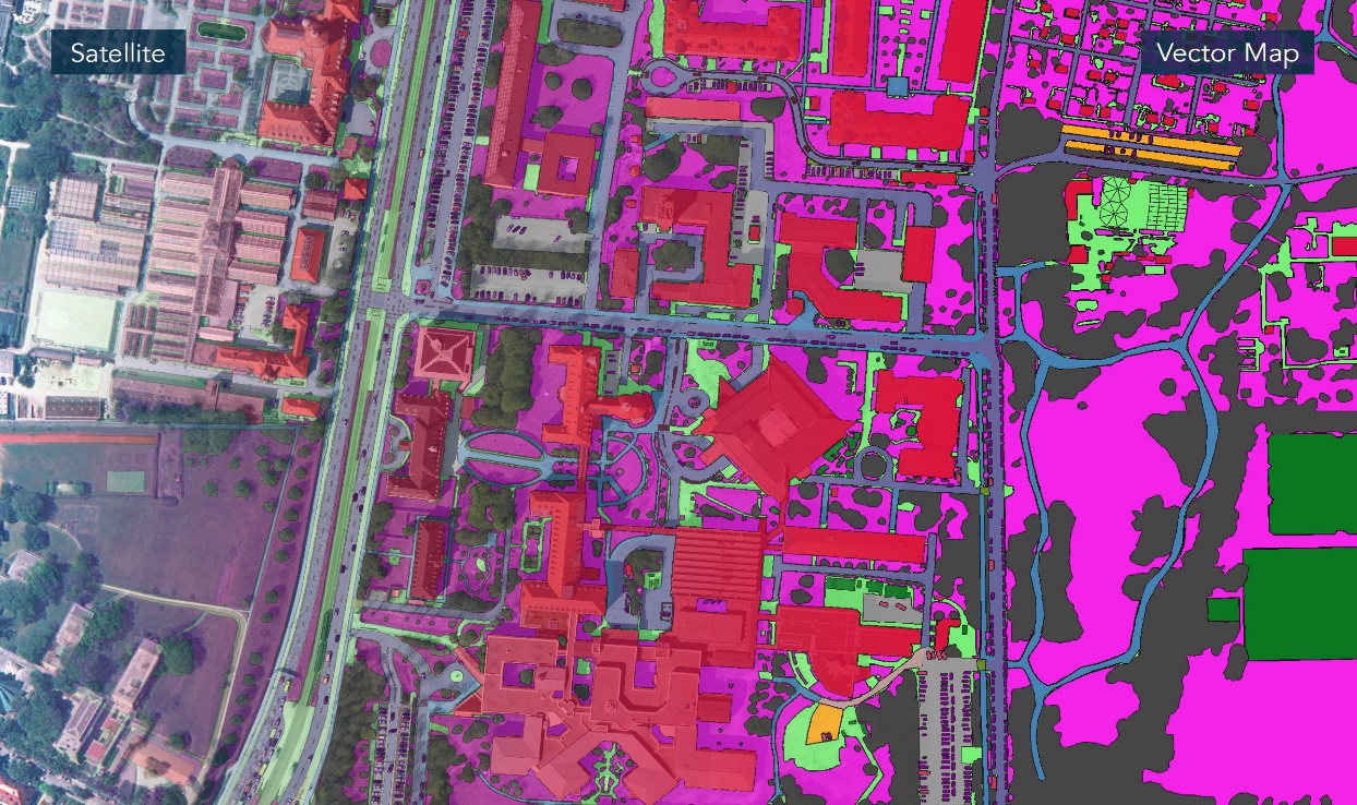
3D SD maps and building models up to LoD3, delivered as OGC CityGML — geometry with meaning, ready to query.
Re-tasked on a cadence and kept current by automatic change detection, so the map tracks reality instead of freezing at capture.
AI produces clean vectors at source — a fraction of the storage, bandwidth and hand-editing a raster-first workflow demands.
Proprietary enhancement sharpens spaceborne pixels (e.g. 30 cm → 7.5 cm) so fine features survive the journey from orbit.
Cloud, night and shadow removal plus SAR-optical fusion deliver analysis-ready imagery in conditions that defeat ordinary optical satellites.
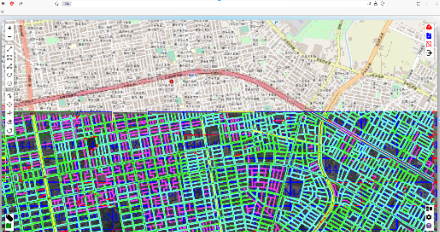
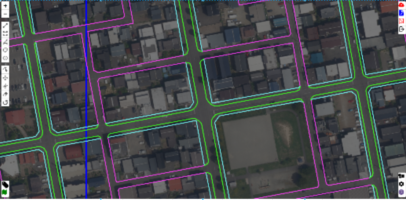
Genuine outputs from our work — HD OpenDRIVE roads, traffic-sign extraction and semantic 3D SD maps. Drag to explore; click to enlarge.

Send us your area of interest and what you need to see. We'll return a sample over your own location and walk you through the platform.