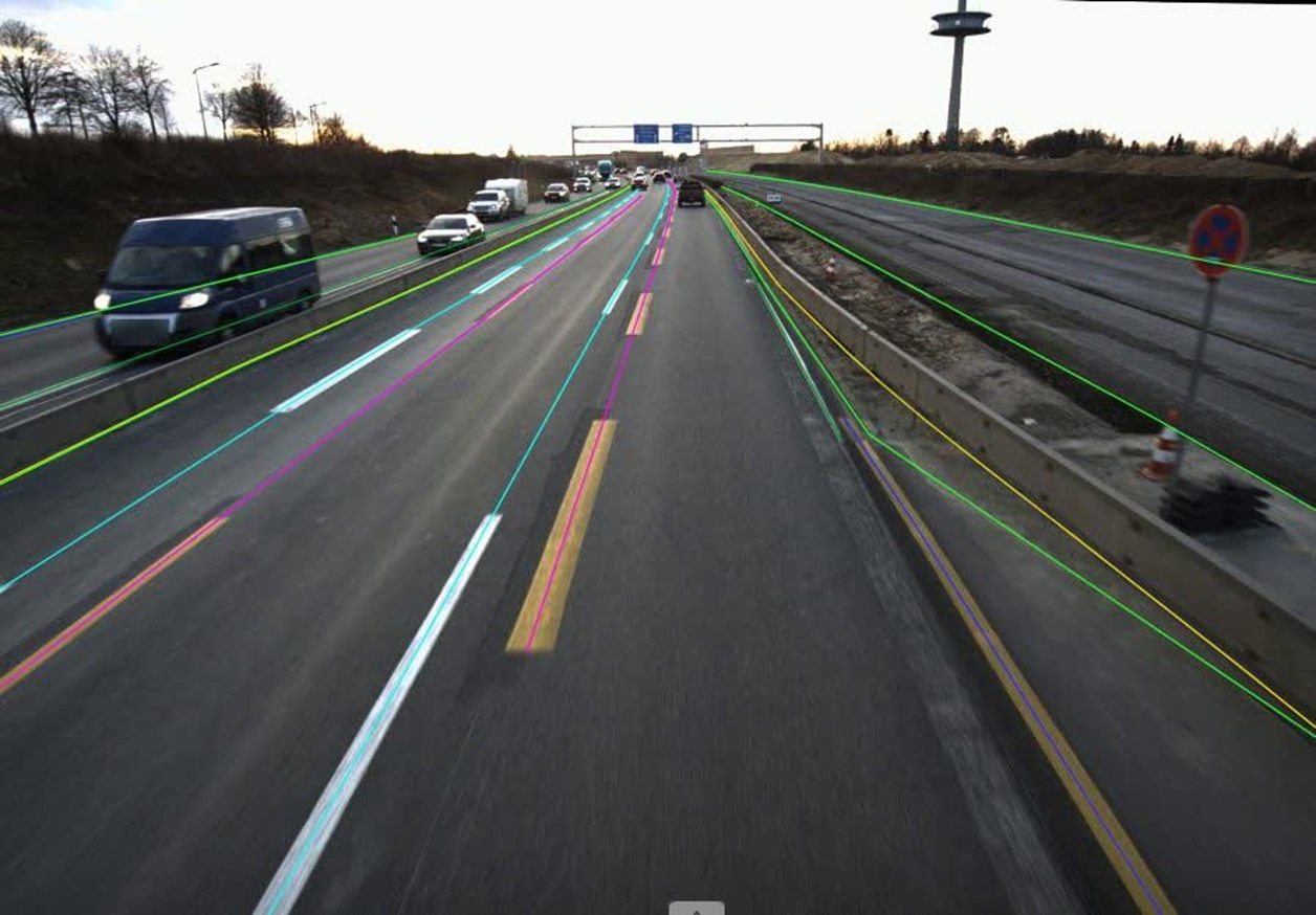
Project scale: 50,000 images · Source: a forward-facing dashboard camera on an electric vehicle · Output: polylines (road boundaries and route paths).
Our AI processed 50,000 dashcam frames from an electric vehicle to extract road boundaries and route paths automatically — lane edges, roadside kerbs and the primary drivable route — delivered as clean polylines for high-definition mapping and autonomy.
Why automation was essential
The images span diverse road types — highways, rural roads, urban streets, curved mountain roads — under varying conditions of day, night, rain, shadow and occlusion. Manual annotation at that scale is simply impossible; the client needed a fully automated pipeline.
What it extracts
- Left and right road boundaries — curbs, edges or lane lines.
- The drivable route path — the centreline of the ego lane or the road as a whole.
Large, consistently labelled datasets like this are what train and validate the perception and mapping models behind driver assistance and autonomous navigation.