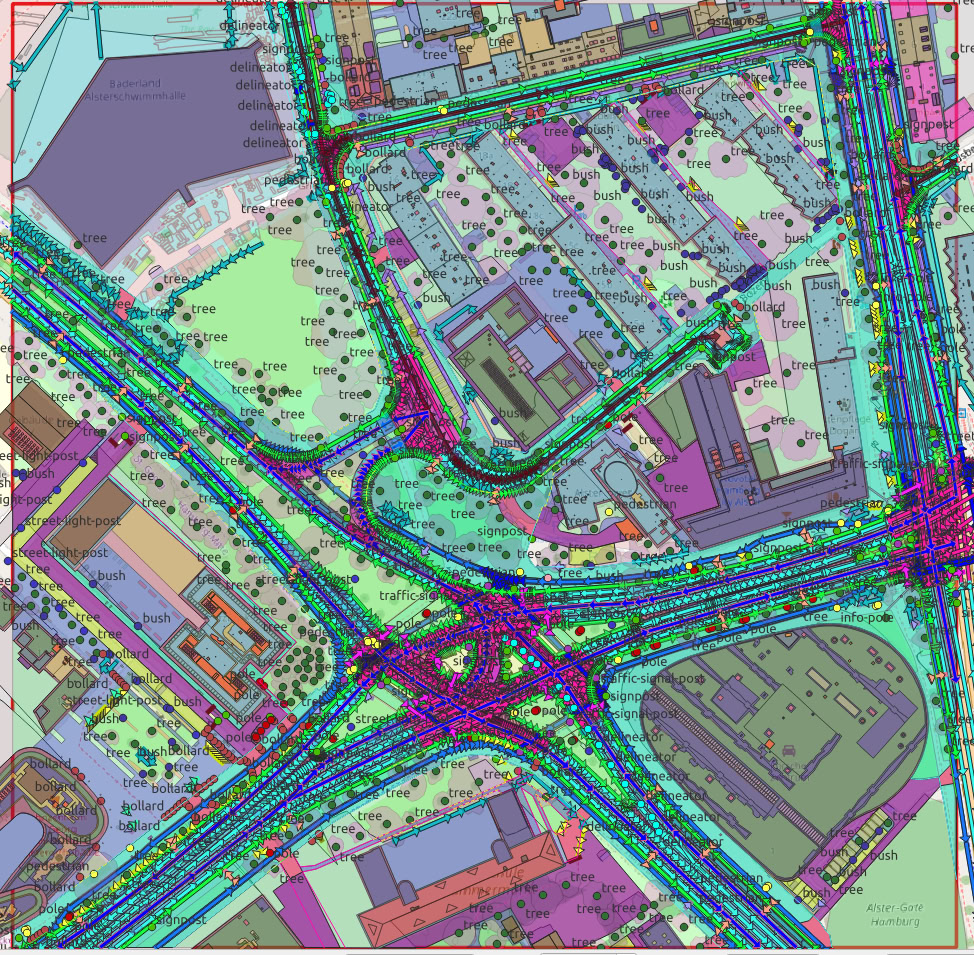
Germany · 2025
Wall-to-wall land-cover classification separating sealed surfaces from vegetation across the metropolitan area.
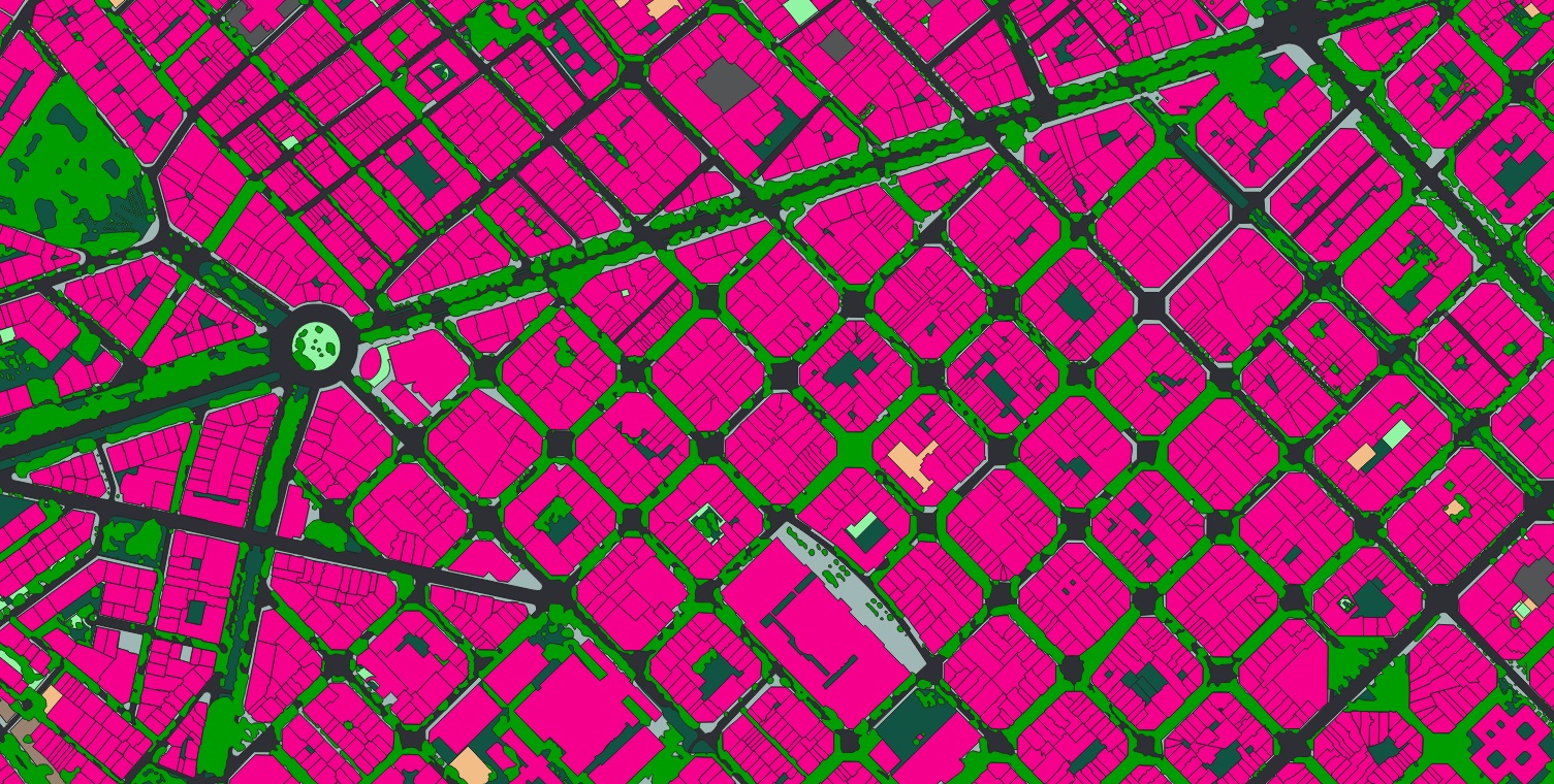
A deep classifier labelled every square metre of the Barcelona area into roofs, roads, pavement, soil, grass, canopy and water, then grouped them into sealed and pervious surface. The result feeds stormwater planning, urban-heat analysis and green-space policy with measured, parcel-level numbers rather than estimates.

